Approximate Location Map
Use two fingers to pan or zoom the map
Use two fingers to pan or zoom the map
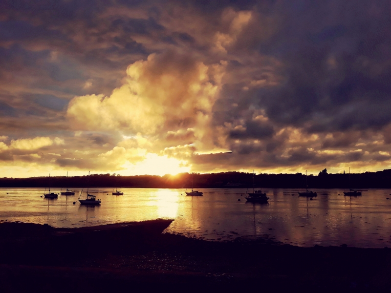
This small beach features a boatyard at one end and a sailing club, which organises regular sailing events ranging from training for juniors to racing at a high level. From the beach, there are views of boats in the Menai Straits and out towards nearby Anglesey. Visitors can find a car park in Port Dinowic, as well as a chip shop and pub, with more extensive facilities available in nearby Bangor.
Abermenai Beach, also known as Traeth Melynog, is a long sandy beach with views looking across towards Caernarfon. The beach is a spit rather than a traditional beach, characterised by its dynamic geography, shaped by tidal movements and sediment deposition. It is a long, narrow landform made up of sand dunes and shingle that extends into the Menai Strait, marking the entrance to the strait from the southern tip of Anglesey. Visitors can follow the paths across the dunes towards Abermenai Point, the southernmost place in Anglesey, where they can find the derelict ferry house and views of Fort Belan across the water. This area is a great place to take the dog for a long walk, but it's essential to time your visit for low tide, as some paths may be within tidal zones.
Felinheli Sailing Club Beach is adjacent to the Wales Coast Path.
Sand Mud
| Today |  |
|---|---|
| Chance of rain | 70% |
| Max temperature | 16°C |
| feels like | 17°C |
| Wind 15mph |  |
| Max UV Index |  |
| Tonight |  |
|---|---|
| Chance of rain | 93% |
| Min temperature | 15°C |
| feels like | 13°C |
| Wind 18mph |  |
The tide at Felinheli Sailing Club Beach is currently rising. High tide will be at approximately 1:36 AM, and the next low tide will be at approximately 8:23 AM.
 Today's air pollution levels are forecast to be Low
 Food available
 Toilets
 Shops
Shops
 Slipway
There is a car park near the beach.
No lifeguard cover at this beach

Water quality not measured here
around 2 miles southwest as the seagull flies, around 2 miles by road.
around 4 miles northeast as the seagull flies, around 4 miles by road.
around 8 miles northeast as the seagull flies, around 9 miles by road.
around 8 miles west-southwest as the seagull flies, around 15 miles by road.
around 8 miles north as the seagull flies, around 11 miles by road.
around 8 miles north as the seagull flies, around 11 miles by road.
around 9 miles southwest as the seagull flies, around 12 miles by road.
around 9 miles north-northeast as the seagull flies, around 13 miles by road.
around 9 miles north as the seagull flies, around 12 miles by road.
around 9 miles north as the seagull flies, around 12 miles by road.
around 10 miles northeast as the seagull flies, around 13 miles by road.
around 10 miles west as the seagull flies, around 19 miles by road.
around 11 miles south-southwest as the seagull flies, around 12 miles by road.
around 11 miles east-northeast as the seagull flies, around 13 miles by road.
around 12 miles north as the seagull flies, around 15 miles by road.
around 12 miles west as the seagull flies, around 20 miles by road.
around 12 miles west as the seagull flies, around 20 miles by road.
around 12 miles west as the seagull flies, around 20 miles by road.
around 12 miles north as the seagull flies, around 15 miles by road.
around 13 miles west as the seagull flies, around 20 miles by road.
Location: Y Felinheli
Location type: Town
OS Grid: SH522674
Coordinates: 53°11'0"N 4°12'45"W
Mapcode: GBR 5L.3H4S
What 3 Words: rival.bloodshot.cupboards
Coordinates and location codes are for an approximate mid-point of the beach, and may not reflect the best access point or the most popular part of the beach.
Country: Wales
Local Authority: Gwynedd
Parish: Y Felinheli
Nearest postcode: LL56 4RQ
(for sat-nav purposes only, a beach does not have a postal address!)
Important! Beach information is compiled from a variety of different sources and is correct to the best of our knowledge at the time of compilation. However, information may be incorrectly supplied by our sources or go out of date after publication. BritishBeaches.uk makes no warranty as to the accuracy of any information on this page.