Approximate Location Map
Use two fingers to pan or zoom the map
Use two fingers to pan or zoom the map
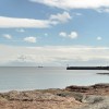
There are four designated bathing waters located around the bay - Wherry Town, Penzance, Heliport and Marazion. All the beaches are sandy resorts backed by sea defences. Heliport beach is approximately one kilometre wide. The Ponsandane Brook flows onto the western end of Heliport beach.
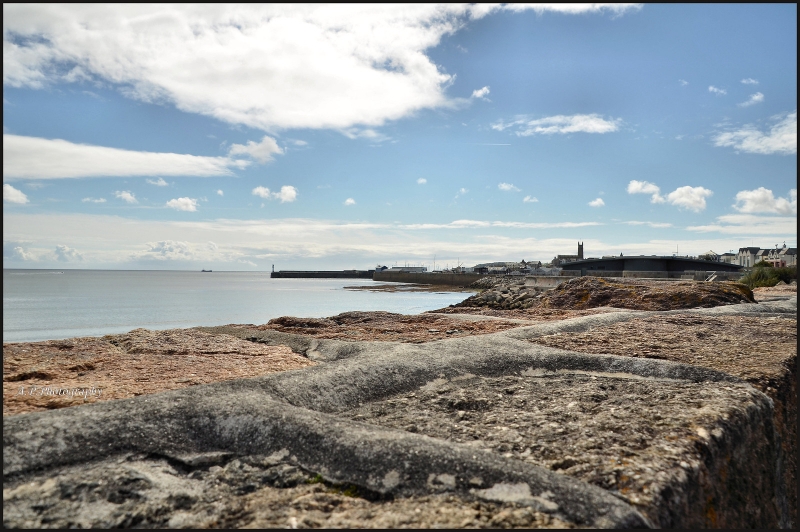
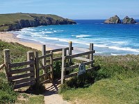
Long Rock Beach is adjacent to the South West Coast Path.
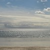
Sand
| Today | |
|---|---|
| Chance of rain | 1% |
| Max temp. | 12°C |
| (feels like | 10°C) |
| Wind 16mph | |
| Max UV Index |
| Tonight | |
|---|---|
| Chance of rain | 0% |
| Min temp. | 7°C |
| (feels like | 6°C) |
| Wind 7mph |
The tide at Long Rock Beach is currently rising. High tide will be at approximately 3:59 PM, and the next low tide will be at approximately 10:33 PM.
![]() Today's air pollution levels are forecast to be Low
Today's air pollution levels are forecast to be Low
 Approximate sea surface temperature:
11.7°C
Approximate sea surface temperature:
11.7°C
There are three large car parks nearby for 600 cars with disabled spaces.
Dogs are allowed but must be kept under control.
Beach cleaned regularly.
No information available
![]()
Excellent water quality
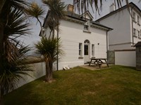
Cornwall Cottage
From £502.00 per week at Holidaycottages.co.uk
Cornwall Cottage
From £723.00 per week at Holidaycottages.co.uk
Kernow Cottage

From £2194.00 per week at Sykes Holiday Cottages
Hunrosa

From £3030.00 per week at Sykes Holiday Cottages
Guillemot

From £4505.00 per week at Sykes Holiday Cottages
Solebay Cottage

From £336.00 per week at Rural Retreats
Marine Discovery (0.7 miles)
Mermaid Pleasure Trips (0.8 miles)
Eureka Escape Cornwall (0.9 miles)
Lands End Cycle Hire (1.2 miles)
Kernow Coasteering (1.4 miles)
Ocean High (1.8 miles)
Newlyn Filmhouse (1.9 miles)
St. Michael's Mount (1.9 miles)
Cornwalls Great Escape Rooms Ltd (2 miles)
Western Discoveries Day Tours (2.6 miles)
Thai Moon (270 yards)
All distances are approximate
around 6 miles north-northeast as the seagull flies, around 9 miles by road.
around 6 miles north-northeast as the seagull flies, around 8 miles by road.
around 7 miles north-northeast as the seagull flies, around 9 miles by road.
around 6 miles north-northeast as the seagull flies, around 8 miles by road.
around 9 miles northeast as the seagull flies, around 11 miles by road.
around 10 miles east-southeast as the seagull flies, around 13 miles by road.
around 2 miles southwest as the seagull flies, around 2 miles by road.
around 5 miles south-southwest as the seagull flies, around 8 miles by road.
less than a mile west-southwest as the seagull flies, less than a mile by road.
around 8 miles west-southwest as the seagull flies, around 9 miles by road.
around 8 miles west as the seagull flies, around 10 miles by road.
around 7 miles west-northwest as the seagull flies, around 9 miles by road.
around 5 miles north-northwest as the seagull flies, around 6 miles by road.
Location: Chyandour,
Location type: Urban
OS Grid: SW485310
Country: England
Local Authority: Cornwall
Parish: Penzance
Nearest postcode: TR18 3DP
(for sat-nav purposes only, a beach does not have a postal address!)
Important! Beach information is compiled from a variety of different sources and is correct to the best of our knowledge at the time of compilation. However, information may be incorrectly supplied by our sources or go out of date after publication. BritishBeaches.uk makes no warranty as to the accuracy of any information on this page.
(Or après-beach. Or pre-beach. Or, just because you might want stuff)
Women's Trousers
Weird Fish Rini Organic Slim Fit Denim Jeans Grey Wash Size 18 Short

Only £30.00 from Weird Fish