Approximate Location Map
Use two fingers to pan or zoom the map
Use two fingers to pan or zoom the map
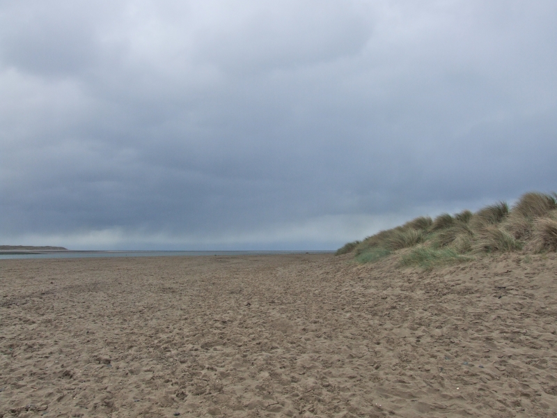
Aberdyfi Beach, also known as Aberdovey Beach, is a long, unspoilt, sandy beach stretching for over 3 miles from the mouth of the River Dyfi (also known as the River Dovey) in the south, opposite the village of Aberdyfi, up towards Tywyn to the north. The beach faces south west towards Cardigan Bay and is steep and shelving with strong currents from the Dyfi estuary.
The coastal waters and surrounding area are listed as a Ramsar site, and also include the Dyfi Estuary Special Protection Area, the Lleyn Peninsula and Sarnau Special Area of Conservation and the Dyfi Site of Special Scientific Interest. This confirms the high conservation status of the area. The beach is backed by some sand dunes and the Aberdovey Golf Club, which offers excellent views of the surrounding coastline.
Walking is a popular pastime in the area, both on the beach and in the surrounding mountains. Sailing and windsurfing are also popular here, and yachting races are sometimes held in the summer months. Visitors can access the beach via a ramp or a short flight of stairs from a large pay-for car park in Aberdyfi, next to the tourist information centre. Public toilets can be found at the tourist information centre, with further facilities such as shops, cafes, and restaurants located along Terrace Road, adjacent to the beach.
The town has a railway station (Aberdovey) located next to the golf course and holiday park, a short walk from the beach, with regular services along the Cambrian Coast Line, and occasional services as far as Birmingham. Aberdyfi is popular with holidaymakers in North Wales looking for water sports, including sailing, sailboarding, fishing and local boat trips. There is also an 18 hole championship golf course overlooking the beach, and local events and a summer regatta take place in the area.
Aberdyfi Beach is adjacent to the Wales Coast Path.
Estuary Sand
| Today |  |
|---|---|
| Chance of rain | 94% |
| Max temperature | 17°C |
| feels like | 18°C |
| Wind 20mph |  |
| Max UV Index |  |
| Tonight |  |
|---|---|
| Chance of rain | 75% |
| Min temperature | 16°C |
| feels like | 14°C |
| Wind 20mph | |
The tide at Aberdyfi Beach is currently rising. High tide will be at approximately 12:59 PM, and the next low tide will be at approximately 7:26 PM.
 Today's air pollution levels are forecast to be Low
 Food available
 Toilets
 Shops
Shops
 Slipway
Parking is available.
Dog restrictions apply on certain areas.
No lifeguard cover at this beach

Sufficient water quality
just over a mile south as the seagull flies, around 25 miles by road.
around 2 miles south as the seagull flies, around 24 miles by road.
around 3 miles northwest as the seagull flies, around 5 miles by road.
around 4 miles south as the seagull flies, around 25 miles by road.
around 8 miles south as the seagull flies, around 29 miles by road.
around 8 miles south as the seagull flies, around 30 miles by road.
around 9 miles south as the seagull flies, around 30 miles by road.
around 9 miles north-northwest as the seagull flies, around 13 miles by road.
around 9 miles south as the seagull flies, around 30 miles by road.
around 10 miles south as the seagull flies, around 30 miles by road.
around 11 miles north as the seagull flies, around 15 miles by road.
around 12 miles south-southwest as the seagull flies, around 33 miles by road.
around 12 miles north as the seagull flies, around 29 miles by road or 20 miles on foot using coastal paths.
around 16 miles north as the seagull flies, around 33 miles by road or 25 miles on foot using coastal paths.
around 17 miles north as the seagull flies, around 35 miles by road or 26 miles on foot using coastal paths.
around 18 miles south-southwest as the seagull flies, around 38 miles by road.
around 19 miles south-southwest as the seagull flies, around 40 miles by road.
around 19 miles south-southwest as the seagull flies, around 40 miles by road.
around 20 miles north as the seagull flies, around 39 miles by road or 30 miles on foot using coastal paths.
around 22 miles south-southwest as the seagull flies, around 43 miles by road.
Location: Aberdyfi (Aberdovey)
Location type: Town
OS Grid: SN612958
Coordinates: 52°32'35"N 4°2'51"W
Mapcode: GBR 8T.DVBW
What 3 Words: yacht.emulating.lectured
Coordinates and location codes are for an approximate mid-point of the beach, and may not reflect the best access point or the most popular part of the beach.
Country: Wales
Local Authority: Gwynedd
Parish: Aberdovey
Nearest postcode: LL35 0EA
(for sat-nav purposes only, a beach does not have a postal address!)
Important! Beach information is compiled from a variety of different sources and is correct to the best of our knowledge at the time of compilation. However, information may be incorrectly supplied by our sources or go out of date after publication. BritishBeaches.uk makes no warranty as to the accuracy of any information on this page.