Approximate Location Map
Use two fingers to pan or zoom the map
Use two fingers to pan or zoom the map
Bournemouth ranks as one of the most popular resorts on the south coast of England, boasting a range of attractions and facilities to cater for nearly every taste.
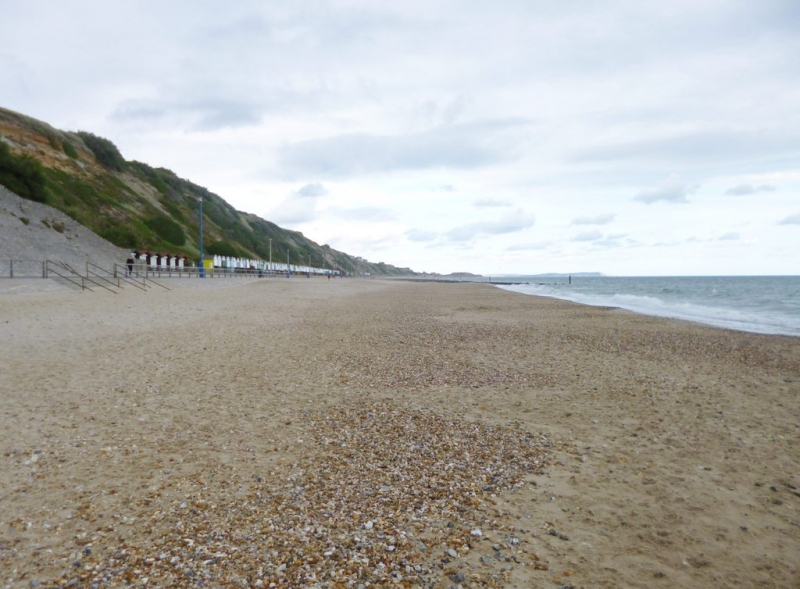
Fisherman's Walk Beach is a firm favourite with families, providing good bathing areas and easy access via a cliff lift, cliff paths, or level promenade from nearby Boscombe. The beach is sandy with some shingle and has no sudden shelves or rip currents, making it generally safe for swimming.
A range of facilities are provided, including a cafe, putting green, and children's park on the cliff top, as well as lifeguards and zoning of watercraft away from swimmers. Visitors can also enjoy canoeing, kayaking, fishing, jet-skiing, sailing, and surfing. The beach holds a Blue Flag award and offers food and drink outlets, toilets, and beach huts and deckchairs for hire.
The cliff lift provides easy access to the seafront, and there is also a gentle zigzag path down to the beach. Free LV= Kidzone children's safety wristbands are available from the beach office, and a lifeguard service operates in June, July, and August.
During the summer months, dogs are not permitted on the beach, although there is a dog exercise area between Fisherman's Walk and Southbourne beach. Cycling is not permitted in high season (July and August).
There are food and drink outlets and toilets available, as well as a crazy golf course and a children's playground. Free parking is available on the road at the top of the cliffs, and three new fixed electric BBQ facilities were installed in 2021, two of which are wheelchair accessible.
Bournemouth Fisherman's Walk Beach is adjacent to the Bournemouth Coast Path.
Bay Sand Shingle
| Tonight |  |
|---|---|
| Chance of rain | 18% |
| Min temperature | 15°C |
| feels like | 15°C |
| Wind 16mph |  |
| Tomorrow |
 |
|---|---|
| Chance of rain | 68% |
| Max temperature | 19°C |
| feels like | 18°C |
| Wind 19mph | |
| Max UV Index |  |
The tide at Bournemouth Fisherman's Walk Beach is currently rising. High tide will be at approximately 11:53 PM, and the next low tide will be at approximately 7:56 AM tomorrow.
 Today's air pollution levels are forecast to be Low
 Food available
 Toilets
 Litter bins
Roadside parking along the overcliff drive. Other pay and display car parks available.
Dogs allowed between 1st October - 30th April. Dogs allowed on certain areas of the beach.
Cleaned daily during the summer and weekly the rest of the year.

Daily - 18th June - 25th September



Water quality not measured here
less than a mile west as the seagull flies, less than a mile by road.
just over a mile west as the seagull flies, just over a mile by road.
just over a mile east as the seagull flies, just over a mile by road.
around 2 miles west as the seagull flies, around 2 miles by road.
around 2 miles east as the seagull flies, around 2 miles by road.
around 3 miles west as the seagull flies, around 3 miles by road.
around 3 miles east as the seagull flies, around 5 miles by road or 4 miles on foot using coastal paths.
around 3 miles west as the seagull flies, around 4 miles by road.
around 3 miles east as the seagull flies, around 5 miles by road.
around 3 miles west as the seagull flies, around 6 miles by road or 4 miles on foot using coastal paths.
around 4 miles west-southwest as the seagull flies, around 6 miles by road or 4 miles on foot using coastal paths.
around 5 miles west-southwest as the seagull flies, around 7 miles by road or 5 miles on foot using coastal paths.
around 5 miles west-southwest as the seagull flies, around 7 miles by road or 5 miles on foot using coastal paths.
around 5 miles west-southwest as the seagull flies, around 7 miles by road or 6 miles on foot using coastal paths.
around 6 miles west-southwest as the seagull flies, around 8 miles by road or 6 miles on foot using coastal paths.
around 8 miles west as the seagull flies, around 10 miles by road.
around 9 miles west as the seagull flies, around 11 miles by road.
around 10 miles west as the seagull flies, around 11 miles by road.
around 23 miles east-northeast as the seagull flies, around 35 miles by road.
around 3 miles east as the seagull flies, around 5 miles by road.
Location: West Southbourne, Bournemouth
Location type: Urban
OS Grid: SZ129912
Coordinates: 50°43'14"N 1°49'3"W
Mapcode: GBR XH7.N2
What 3 Words: groups.repair.push
Coordinates and location codes are for an approximate mid-point of the beach, and may not reflect the best access point or the most popular part of the beach.
Country: England
Local Authority: Bournemouth
Nearest postcode: BH6 3TD
(for sat-nav purposes only, a beach does not have a postal address!)
Important! Beach information is compiled from a variety of different sources and is correct to the best of our knowledge at the time of compilation. However, information may be incorrectly supplied by our sources or go out of date after publication. BritishBeaches.uk makes no warranty as to the accuracy of any information on this page.