Approximate Location Map
Use two fingers to pan or zoom the map
Use two fingers to pan or zoom the map
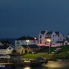
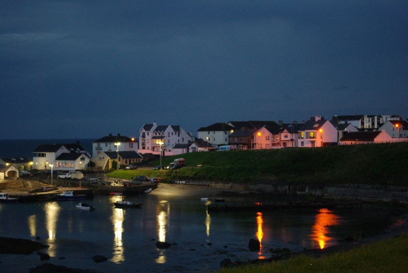
The seaside village of Portballintrae is home to several beaches, including Salmon Rock Beach and Runkerry Beach, also known as Bushfoot Beach.
Salmon Rock Beach is a small, sheltered beach located in Portballintrae, just west of the town's harbour. The beach is a mix of sand, shingle, and rocks, backed by grassy slopes and cliffs. It is a popular spot for paddling, sunbathing, and exploring the rock pools that emerge at low tide. The water is clear and clean, making it suitable for swimming on calm days, although there is no lifeguard on duty. The beach is also suitable for snorkelling and diving, with the rocky bay providing lots of interest.
Runkerry Beach, also known as Bushfoot Beach, is a northwest-facing sandy beach backed by dunes. The beach is located slightly off the beaten path and offers scenic views of the surrounding coastline. On the western side of the beach is the Portballintrae headland and the River Bush. Visitors can walk along the length of the beach to reach the western cliffs of the Giant's Causeway.
Facilities near the beaches are limited, but the village of Portballintrae is only a short walk away, offering parking, toilets, and cafes. Summer restrictions apply to Salmon Rock Beach between 1st June and 15th September.
Portballintrae Beach is adjacent to the Causeway Coast Way.
Harbour Sand Pebbles Rock
| Today | |
|---|---|
| Chance of rain | 100% |
| Max temperature | 14°C |
| feels like | 14°C |
| Wind 21mph | |
| Max UV Index |
| Tonight | |
|---|---|
| Chance of rain | 86% |
| Min temperature | 8°C |
| feels like | 9°C |
| Wind 23mph |
The tide at Portballintrae Beach is currently falling. Low tide will be at approximately 3:49 PM, and the next high tide will be at approximately 10:22 PM.
![]() Today's air pollution levels are forecast to be Low
Today's air pollution levels are forecast to be Low
There is parking next to the beach.
Dog restrictions apply 1st May - 30th September annually.
No information available
Church Studio

From £1002.00 per week at Sykes Holiday Cottages
Horizon Apartments

From £3515.00 per week at Sykes Holiday Cottages
41 Church view

From £2169.00 per week at Sykes Holiday Cottages
Clarmes House

From £2486.00 per week at Sykes Holiday Cottages
Mountain View

From £1795.00 per week at Sykes Holiday Cottages
Seaview

From £2018.00 per week at Sykes Holiday Cottages
Causeway Coastal Route (1.3 miles)
Causeway Coasteering (1.4 miles)
Bushmills Distillery (1.4 miles)
Dunluce Castle (1.4 miles)
Royal Portrush Golf Club - Dunluce Links (2.2 miles)
City and Causeway Tours (3.1 miles)
Giant's Causeway (3.6 miles)
Troggs Surf School (4.2 miles)
Elementary Escape Rooms (4.4 miles)
Barry's Amusements (4.4 miles)
All distances are approximate
around 3 miles west-southwest as the seagull flies, around 3 miles by road.
around 4 miles west-southwest as the seagull flies, around 5 miles by road.
around 4 miles west-southwest as the seagull flies, around 5 miles by road.
around 8 miles west-southwest as the seagull flies, around 11 miles by road.
around 10 miles west-southwest as the seagull flies, around 18 miles by road.
around 12 miles west-southwest as the seagull flies, around 19 miles by road.
around 12 miles east as the seagull flies, around 14 miles by road.
around 13 miles west-southwest as the seagull flies, around 22 miles by road.
around 21 miles east-southeast as the seagull flies, around 25 miles by road.
around 22 miles east-southeast as the seagull flies, around 28 miles by road.
around 27 miles southeast as the seagull flies, around 39 miles by road.
around 27 miles southeast as the seagull flies, around 39 miles by road.
around 29 miles southeast as the seagull flies, around 41 miles by road.
Location: Portballintrae
Coordinates: 55°13'0"N 6°32'39"W
Mapcode: IRL RJ.39WT
What 3 Words: cars.influence.washable
Coordinates and location codes are for an approximate mid-point of the beach, and may not reflect the best access point or the most popular part of the beach.
County: Antrim
Country: Northern Ireland
Local Authority: Coleraine
Nearest postcode: BT57 8RS
(for sat-nav purposes only, a beach does not have a postal address!)
Important! Beach information is compiled from a variety of different sources and is correct to the best of our knowledge at the time of compilation. However, information may be incorrectly supplied by our sources or go out of date after publication. BritishBeaches.uk makes no warranty as to the accuracy of any information on this page.
(Or après-beach. Or pre-beach. Or, just because you might want stuff)
Men's Tops
Weird Fish Reena 1/4 Zip Printed Microfleece Forest Night Size 18

Only £22.00 from Weird Fish