Approximate Location Map
Use two fingers to pan or zoom the map
Use two fingers to pan or zoom the map
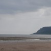
Waterfoot Beach is situated in a wide bay and features a long strip of sand. The beach is flanked by two piers, one of which is old and ruined, located on the south side, and another that is more intact, situated to the north.
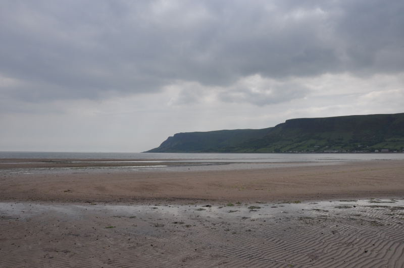
The quiet fishing village of Carnlough is located near the beach and is set at the foot of the Antrim Glens. The village boasts a picturesque harbour and a pleasant sandy beach that stretches around the bay. However, the beach tends to disappear under the high tide towards the village end, whereas there is still some sandy beach further down.
The beach and surrounding area offer a serene and natural environment, with the beach providing a long stretch of sand in a beautiful wide bay. The village of Carnlough adds to the charm of the area, with its pretty harbour and sandy beach.
Sand
| Today | |
|---|---|
| Chance of rain | 100% |
| Max temperature | 14°C |
| feels like | 14°C |
| Wind 18mph | |
| Max UV Index |
| Tonight | |
|---|---|
| Chance of rain | 100% |
| Min temperature | 8°C |
| feels like | 10°C |
| Wind 18mph |
The tide at Waterfoot Beach is currently rising. High tide will be at approximately 2:52 PM, and the next low tide will be at approximately 8:13 PM.
![]() Today's air pollution levels are forecast to be Low
Today's air pollution levels are forecast to be Low
Parking is next to the beach.
Dogs are allowed.
No lifeguard cover at this beach
Hill House

From £1923.00 per week at Sykes Holiday Cottages
Cranny Corner

From £1601.00 per week at Sykes Holiday Cottages
Alken The Hare

From £3959.00 per week at Sykes Holiday Cottages
Alken Cabin

From £1657.00 per week at Sykes Holiday Cottages
Woodleigh Cottage

From £1997.00 per week at Sykes Holiday Cottages
Carriguisnagh

From £2579.00 per week at Sykes Holiday Cottages
Carnlough Bay Boat Tours (0.6 miles)
Glenarm Castle (1.8 miles)
Steensons Jewelers (1.9 miles)
Glenarm forest (1.9 miles)
Glenariff Forest Park Caravan Park (5.5 miles)
Coast Road (6.5 miles)
All distances are approximate
less than a mile north-northwest as the seagull flies, less than a mile by road.
around 2 miles southeast as the seagull flies, around 2 miles by road.
around 7 miles north-northwest as the seagull flies, around 11 miles by road.
around 8 miles southeast as the seagull flies, around 9 miles by road.
around 10 miles north-northwest as the seagull flies, around 16 miles by road.
around 13 miles southeast as the seagull flies, around 27 miles by road.
around 18 miles north-northwest as the seagull flies, around 26 miles by road.
around 24 miles south-southeast as the seagull flies, around 42 miles by road.
around 24 miles south-southeast as the seagull flies, around 43 miles by road.
around 26 miles south-southeast as the seagull flies, around 46 miles by road.
around 26 miles southeast as the seagull flies, around 48 miles by road.
around 27 miles northwest as the seagull flies, around 39 miles by road.
around 29 miles west-northwest as the seagull flies, around 43 miles by road.
around 30 miles west-northwest as the seagull flies, around 44 miles by road.
around 30 miles west-northwest as the seagull flies, around 45 miles by road.
Coordinates: 54°59'4"N 5°59'23"W
Mapcode: IRL VG.XL3X
What 3 Words: ridge.cupboards.admire
Coordinates and location codes are for an approximate mid-point of the beach, and may not reflect the best access point or the most popular part of the beach.
County: Antrim
Country: Northern Ireland
Local Authority: Larne
Nearest postcode: BT44 0JE
(for sat-nav purposes only, a beach does not have a postal address!)
Important! Beach information is compiled from a variety of different sources and is correct to the best of our knowledge at the time of compilation. However, information may be incorrectly supplied by our sources or go out of date after publication. BritishBeaches.uk makes no warranty as to the accuracy of any information on this page.
(Or après-beach. Or pre-beach. Or, just because you might want stuff)
Women's Trousers
Weird Fish Corine Wide Leg Denim Jeans Dark Denim Size 12

Only £45.00 from Weird Fish