Approximate Location Map
Use two fingers to pan or zoom the map
Use two fingers to pan or zoom the map
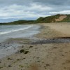
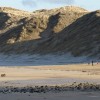
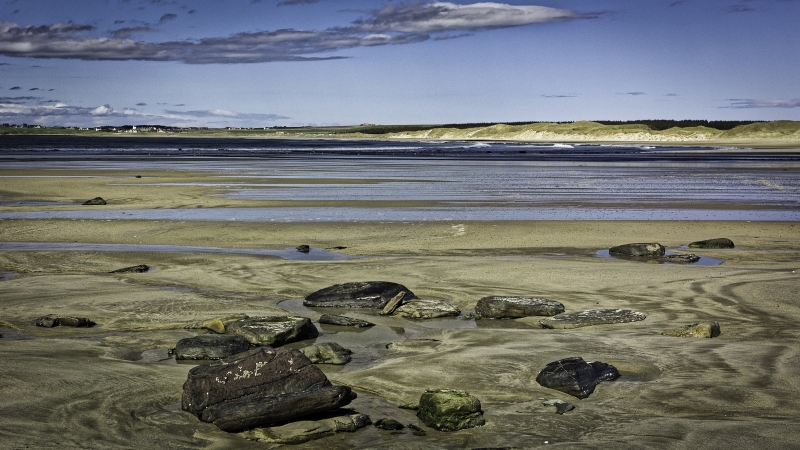
Dunnet Bay is a wide sandy bay that stretches near the eastern tip of Scotland's North coast. The bay joins with Dunnet Beach to the north and offers a range of amenities for visitors.
The bay is situated between Castletown and Dunnet, forming the western end of a long stretch of sand and shingle, backed by grassy dunes. The A836 road runs adjacent to the beach, behind the dunes.
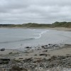
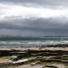
The beach is a popular spot for surfers and those looking for peaceful walks. The area is also renowned for its birdwatching opportunities, particularly at Dunnet Head and St John's Pool.
The nearest facilities can be found in the village of Castletown, which features a working flagstone harbour, a hotel, a guesthouse, a fish and chip shop, and a grocery store. Visitors can also explore a heritage trail that showcases sites connected to the town's flagstone quarrying industry.
Dunnet Head, the headland that marks the most northerly point of the British mainland, lies just beyond the north end of Dunnet/Murkle Bay and is well worth a visit.
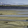
Sand
| Today | |
|---|---|
| Chance of rain | 89% |
| Max temperature | 13°C |
| feels like | 14°C |
| Wind 10mph | |
| Max UV Index |
| Tonight | |
|---|---|
| Chance of rain | 95% |
| Min temperature | 10°C |
| feels like | 11°C |
| Wind 15mph |
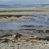
The tide at Dunnet Bay is currently falling. Low tide will be at approximately 5:57 PM, and the next high tide will be at approximately 12:11 AM tomorrow.
![]() Today's air pollution levels are forecast to be Low
Today's air pollution levels are forecast to be Low
Parking available by the beach, off Harbour Road.
No lifeguard cover at this beach
Water quality not measured here
The Auld Kirk

From £2067.00 per week at Sykes Holiday Cottages
Rural Highland Council Farmhouse
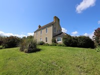
From £561.00 per week at Holidaycottages.co.uk
Dunnet Bay Distillery (1.6 miles)
Dunnet Head (3.7 miles)
The Castle and Gardens of Mey (5.8 miles)
All distances are approximate
just over a mile north-northeast as the seagull flies, around 2 miles by road.
around 6 miles west as the seagull flies, around 7 miles by road.
around 10 miles east-southeast as the seagull flies, around 18 miles by road or 14 miles on foot using coastal paths.
around 12 miles southeast as the seagull flies, around 15 miles by road.
around 16 miles west as the seagull flies, around 18 miles by road.
around 20 miles west as the seagull flies, around 24 miles by road.
around 23 miles west as the seagull flies, around 27 miles by road.
Location: Castletown
Location type: Rural
OS Grid: ND211688
Coordinates: 58°36'0"N 3°21'27"W
Mapcode: GBR L620.2LY
What 3 Words: tonsils.rephrase.unopposed
Coordinates and location codes are for an approximate mid-point of the beach, and may not reflect the best access point or the most popular part of the beach.
Country: Scotland
Local Authority: Highland
Nearest postcode: KW14 8SU
(for sat-nav purposes only, a beach does not have a postal address!)
Important! Beach information is compiled from a variety of different sources and is correct to the best of our knowledge at the time of compilation. However, information may be incorrectly supplied by our sources or go out of date after publication. BritishBeaches.uk makes no warranty as to the accuracy of any information on this page.
(Or après-beach. Or pre-beach. Or, just because you might want stuff)
Men's Tops
Weird Fish Barkson's Farm Back Print Artist T-Shirt Deep Lichen Green Size XL

Only £28.00 from Weird Fish