Approximate Location Map
Use two fingers to pan or zoom the map
Use two fingers to pan or zoom the map
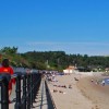
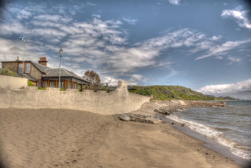
Burntisland Beach is a sand and rock beach situated east of Burntisland, providing stunning views of the Firth of Forth. The beach boasts a traditional seaside setting, complete with a promenade, making it an ideal destination for families.
The beach offers a variety of facilities and activities to cater to different interests. These include:
* A modern leisure centre
* Seaside Park
* Crazy golf
* Bouncy castles
* A summer fairground
The beach provides a range of amenities and features that make it an attractive destination for visitors. Its traditional seaside setting and promenade offer a classic beach experience, while the various facilities and activities available ensure that there is something for everyone to enjoy.
Harbour Sand Rock
| Today |  |
|---|---|
| Chance of rain | 10% |
| Max temperature | 16°C |
| feels like | 16°C |
| Wind 14mph |  |
| Max UV Index |  |
| Tonight |  |
|---|---|
| Chance of rain | 89% |
| Min temperature | 12°C |
| feels like | 10°C |
| Wind 15mph |  |
The tide at Burntisland Beach is currently rising. High tide will be at approximately 6:53 PM, and the next low tide will be at approximately 12:00 AM tomorrow.
 Today's air pollution levels are forecast to be Low
 Food available
 Toilets
 Shops
Shops
 Litter bins
 Slipway
Free parking.
Dog ban on beach.
Beach cleaned weekly during the summer.

Daily - 25th June - 21st August



Good water quality
just over a mile east as the seagull flies, around 2 miles by road or 2 miles on foot using coastal paths.
around 2 miles east-northeast as the seagull flies, around 2 miles by road.
around 3 miles west as the seagull flies, around 4 miles by road or 3 miles on foot using coastal paths.
around 3 miles west-southwest as the seagull flies, around 4 miles by road.
around 3 miles northeast as the seagull flies, around 4 miles by road.
around 4 miles northeast as the seagull flies, around 5 miles by road.
around 5 miles northeast as the seagull flies, around 6 miles by road.
around 5 miles west-southwest as the seagull flies, around 9 miles by road or 7 miles on foot using coastal paths.
around 6 miles south-southwest as the seagull flies, around 22 miles by road.
around 6 miles south-southwest as the seagull flies, around 20 miles by road.
around 8 miles south-southeast as the seagull flies, around 26 miles by road.
around 8 miles south-southeast as the seagull flies, around 37 miles by road or 25 miles on foot using coastal paths.
around 9 miles south-southeast as the seagull flies, around 39 miles by road or 25 miles on foot using coastal paths.
around 10 miles southeast as the seagull flies, around 37 miles by road or 28 miles on foot using coastal paths.
around 10 miles southeast as the seagull flies, around 37 miles by road or 28 miles on foot using coastal paths.
around 12 miles east-southeast as the seagull flies, around 42 miles by road or 33 miles on foot using coastal paths.
around 13 miles northeast as the seagull flies, around 15 miles by road.
around 13 miles east-southeast as the seagull flies, around 43 miles by road or 34 miles on foot using coastal paths.
around 13 miles east-southeast as the seagull flies, around 44 miles by road.
around 13 miles east-southeast as the seagull flies, around 45 miles by road.
Location: Burntisland
Location type: Town
OS Grid: NT240859
Coordinates: 56°3'38"N 3°13'14"W
Mapcode: GBR 27.Q2DX
What 3 Words: code.skimmers.makeup
Coordinates and location codes are for an approximate mid-point of the beach, and may not reflect the best access point or the most popular part of the beach.
Country: Scotland
Local Authority: Fife Council
Nearest postcode: KY3 9JZ
(for sat-nav purposes only, a beach does not have a postal address!)
Important! Beach information is compiled from a variety of different sources and is correct to the best of our knowledge at the time of compilation. However, information may be incorrectly supplied by our sources or go out of date after publication. BritishBeaches.uk makes no warranty as to the accuracy of any information on this page.