Approximate Location Map
Use two fingers to pan or zoom the map
Use two fingers to pan or zoom the map
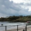
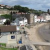
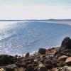
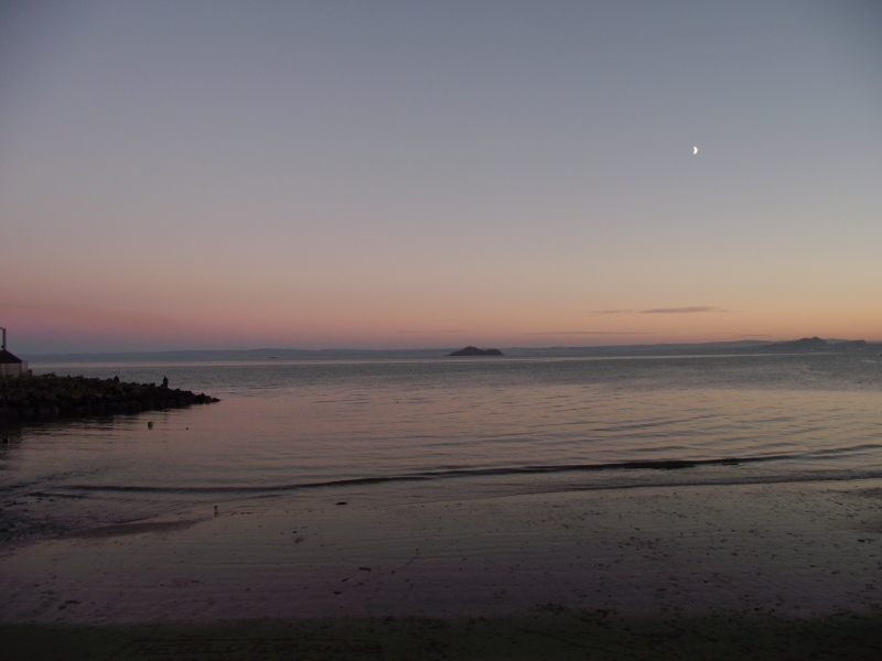
Kinghorn Harbour Beach is a charming beach situated in the burgh of Kinghorn, overlooking the Firth of Forth. The beach is flanked by a harbour on one side and a lifeboat station on the other. Notably, the lifeboat station is one of the busiest rescue centres in Scotland.
The beach offers a range of amenities, including a beachfront cafe, ample parking, and scenic footpaths that wind through the cliffs and surrounding area. The village of Kinghorn overlooks the beach, providing a picturesque backdrop. The beach is a popular spot for families with young children and those who enjoy walking.
Kinghorn has two tidal harbours, both of which face out onto sandy beaches at low tide. The beach's location makes it an ideal spot for those looking to enjoy the scenic views of the Firth of Forth.
Harbour Sand Rock
| Today | |
|---|---|
| Chance of rain | 98% |
| Max temperature | 15°C |
| feels like | 15°C |
| Wind 19mph | |
| Max UV Index |
| Tonight | |
|---|---|
| Chance of rain | 37% |
| Min temperature | 11°C |
| feels like | 12°C |
| Wind 19mph |
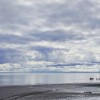
The tide at Kinghorn Harbour Beach is currently rising. High tide will be at approximately 5:47 AM, and the next low tide will be at approximately 11:33 AM.
![]() Today's air pollution levels are forecast to be Low
Today's air pollution levels are forecast to be Low
Free Parking available near the eastern harbour and beach.
No lifeguard cover at this beach
![]()
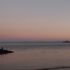
Poor water quality - bathing not advised
Romantic Scottish Borders Farm Cottage

From £673.00 per week at Holidaycottages.co.uk
East Cottage - Tarvit

From £2805.00 per week at Sykes Holiday Cottages
Luxury Romantic Fife Farm Cottage

From £1049.00 per week at Holidaycottages.co.uk
Midlothian Cottage
From £516.00 per week at Holidaycottages.co.uk
Romantic Edinburgh Apartment
From £399.00 per week at Holidaycottages.co.uk
Luxury Romantic Fife Lodge
From £1139.00 per week at Holidaycottages.co.uk
Burntisland Golf House Club (1.9 miles)
The Dive Bunker (2.3 miles)
Beveridge Park (2.5 miles)
Museum of Communication (2.5 miles)
Adam Smith Theatre (3 miles)
Kirkcaldy Galleries (3 miles)
Betty Nicols Bar and Bistro (3.1 miles)
Ravenscraig Park (3.9 miles)
Ravenscraig Castle (3.9 miles)
Dysart Harbour & Harbourmaster's House (4.2 miles)
All distances are approximate
less than a mile southwest as the seagull flies, less than a mile by road.
around 2 miles north-northeast as the seagull flies, around 3 miles by road or 2 miles on foot using coastal paths.
around 2 miles west-southwest as the seagull flies, around 3 miles by road or 2 miles on foot using coastal paths.
around 2 miles north-northeast as the seagull flies, around 3 miles by road.
around 4 miles north-northeast as the seagull flies, around 4 miles by road.
around 5 miles west-southwest as the seagull flies, around 6 miles by road.
around 5 miles west-southwest as the seagull flies, around 6 miles by road.
around 7 miles south-southwest as the seagull flies, around 24 miles by road.
around 7 miles west-southwest as the seagull flies, around 11 miles by road or 9 miles on foot using coastal paths.
around 8 miles southwest as the seagull flies, around 23 miles by road.
around 8 miles south-southeast as the seagull flies, around 29 miles by road.
around 8 miles south-southeast as the seagull flies, around 40 miles by road or 27 miles on foot using coastal paths.
around 9 miles south-southeast as the seagull flies, around 42 miles by road or 27 miles on foot using coastal paths.
around 9 miles south-southeast as the seagull flies, around 40 miles by road or 30 miles on foot using coastal paths.
around 9 miles south-southeast as the seagull flies, around 40 miles by road or 30 miles on foot using coastal paths.
around 11 miles southeast as the seagull flies, around 45 miles by road or 35 miles on foot using coastal paths.
around 11 miles northeast as the seagull flies, around 13 miles by road.
around 12 miles east-southeast as the seagull flies, around 46 miles by road or 36 miles on foot using coastal paths.
around 12 miles east-southeast as the seagull flies, around 47 miles by road.
around 12 miles east-southeast as the seagull flies, around 48 miles by road.
Location: Kinghorn
Location type: Village
OS Grid: NT271868
Coordinates: 56°4'8"N 3°10'18"W
Mapcode: GBR 29.PMC7
What 3 Words: snowstorm.majors.trinkets
Coordinates and location codes are for an approximate mid-point of the beach, and may not reflect the best access point or the most popular part of the beach.
Country: Scotland
Local Authority: Fife Council
Nearest postcode: KY3 9SX
(for sat-nav purposes only, a beach does not have a postal address!)
Important! Beach information is compiled from a variety of different sources and is correct to the best of our knowledge at the time of compilation. However, information may be incorrectly supplied by our sources or go out of date after publication. BritishBeaches.uk makes no warranty as to the accuracy of any information on this page.
(Or après-beach. Or pre-beach. Or, just because you might want stuff)
Women's Outerwear
Weird Fish Atissa Lightweight Padded Gilet Deep Lichen Green Size 18

Only £48.75 from Weird Fish