Approximate Location Map
Use two fingers to pan or zoom the map
Use two fingers to pan or zoom the map
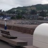
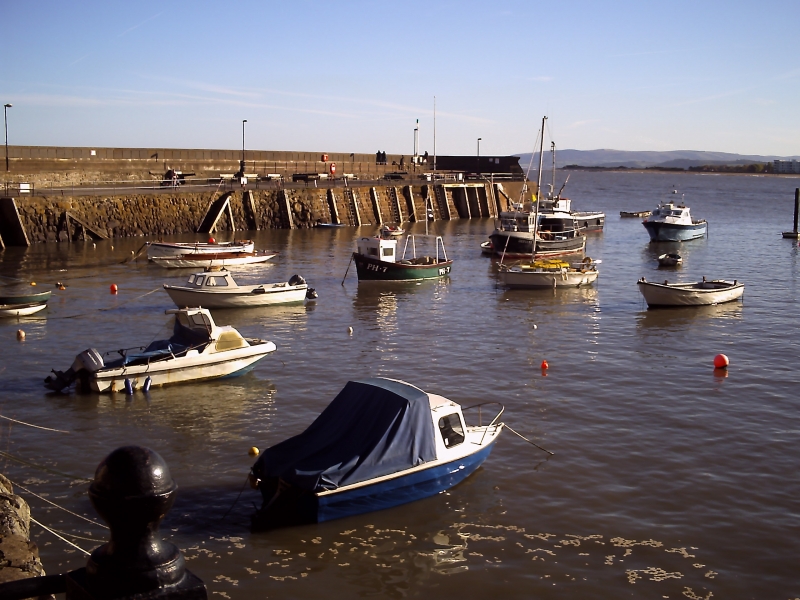
Minehead is one of Somerset's busiest holiday resorts, with many amenities and a wide sand and shingle beach that faces North-to-North West and looks out across the Bristol Channel towards Wales. The beach, also known as The Strand, is a wide expanse of sand, with some areas of shingle and a variety of rock pools. As the tide goes out, this sandy stretch of beach becomes ideal for beach games and for building sandcastles.
The promenade, lined with cafés, bars, and shops, offers access to the sandy beach and spectacular views across to North Hill. The beachfront is also overlooked by a large Butlin’s holiday camp, adding to the lively atmosphere of the resort. Visitors can enjoy a range of water sports, including sailing and windsurfing, as well as sports and leisure activities at the Butlin's camp. The resort is also a nature lover's destination, with the gateway to Exmoor National Park and various walks and stunning landscapes to explore.
Minehead is the official starting point for the South West Coast Path, which runs all the way to Poole in Dorset via Land’s End in Cornwall. The full trail is 630 miles long. The resort is also home to Somerset’s oldest golf course – the Minehead and West Somerset Golf Club.
Dogs are restricted on the beach between the Harbour and the Minehead and West Somerset Golf Club from May through September. There is a café on the beachfront, but the nearest public toilets are a little walk away from the beach. There is no lifeguard on duty.
In 1990, a large section of the beach was washed away by storms. Since then, new improved sea defences have been installed, including a long sea-wall which runs along the shore. However, these sea defences have caused a lot of the sand to be washed away.
Sand
| Today |  |
|---|---|
| Chance of rain | 39% |
| Max temperature | 17°C |
| feels like | 17°C |
| Wind 15mph |  |
| Max UV Index |  |
| Tonight |  |
|---|---|
| Chance of rain | 68% |
| Min temperature | 14°C |
| feels like | 13°C |
| Wind 14mph |  |
The tide at Minehead Strand Beach is currently falling. Low tide will be at approximately 3:43 PM, and the next high tide will be at approximately 10:18 PM.
 Today's air pollution levels are forecast to be Low
 Campsite
 Food available
 Toilets
 Shops
Shops
Pay and display parking available.
Dog restrictions apply.
No lifeguard cover at this beach

Water quality not measured here
less than a mile west as the seagull flies, less than a mile by road or less than a mile on foot using coastal paths.
just over a mile east-southeast as the seagull flies, around 3 miles by road.
around 2 miles southeast as the seagull flies, around 3 miles by road.
around 3 miles east-southeast as the seagull flies, around 5 miles by road or 4 miles on foot using coastal paths.
around 6 miles east-southeast as the seagull flies, around 9 miles by road.
around 7 miles east-southeast as the seagull flies, around 11 miles by road.
around 7 miles west as the seagull flies, around 9 miles by road.
around 10 miles east as the seagull flies, around 15 miles by road.
around 12 miles north as the seagull flies, around 109 miles by road.
around 13 miles north-northeast as the seagull flies, around 110 miles by road.
around 13 miles north as the seagull flies, around 113 miles by road.
around 13 miles north as the seagull flies, around 113 miles by road.
around 14 miles north-northeast as the seagull flies, around 106 miles by road.
around 15 miles north-northeast as the seagull flies, around 106 miles by road.
around 15 miles north-northeast as the seagull flies, around 106 miles by road.
around 15 miles north-northeast as the seagull flies, around 106 miles by road.
around 15 miles north-northeast as the seagull flies, around 106 miles by road.
around 16 miles northeast as the seagull flies, around 105 miles by road.
around 16 miles west as the seagull flies, around 19 miles by road.
around 17 miles west as the seagull flies, around 20 miles by road.
Location: Minehead
Location type: Urban
OS Grid: SS980464
Coordinates: 51°12'28"N 3°27'38"W
Mapcode: GBR LK.4148
What 3 Words: stuffy.contracts.trickles
Coordinates and location codes are for an approximate mid-point of the beach, and may not reflect the best access point or the most popular part of the beach.
County: Somerset
Country: England
Local Authority: West Somerset
Parish: Minehead
Nearest postcode: TA24 6GW
(for sat-nav purposes only, a beach does not have a postal address!)
Important! Beach information is compiled from a variety of different sources and is correct to the best of our knowledge at the time of compilation. However, information may be incorrectly supplied by our sources or go out of date after publication. BritishBeaches.uk makes no warranty as to the accuracy of any information on this page.