Approximate Location Map
Use two fingers to pan or zoom the map
Use two fingers to pan or zoom the map
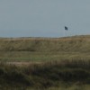
Turnberry Beach is a wide sandy beach backed by an extensive sand dune system and the renowned Ailsa Golf Course. The beach looks out over the Firth of Clyde, with picturesque views across to the mountainous Isle of Arran.
The beach is a regular venue for the Open Championship, making it a popular destination for golf enthusiasts. In addition to golf, the area is also favoured by keen walkers, with the Ayrshire Coastal Path passing the beach. Visitors can walk to the north of the beach to explore Turnberry Lighthouse, now part of the Trump Turnberry luxury hotel, which is attached to the local golf courses. The lighthouse is situated on the site of Turnberry Castle, the birthplace of Robert the Bruce.
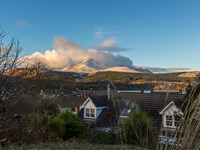
The village of Turnberry is located at the southern end of the beach, offering parking facilities and a range of accommodation options for those looking to enjoy the local walks and golf.
Turnberry Beach is adjacent to the Ayrshire Coastal Path.
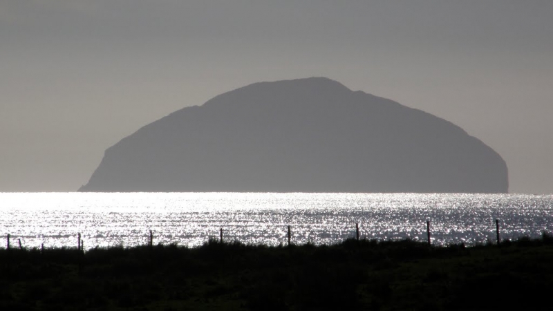
Sand Rock
| Today | |
|---|---|
| Chance of rain | 99% |
| Max temperature | 13°C |
| feels like | 12°C |
| Wind 20mph | |
| Max UV Index |
| Tonight | |
|---|---|
| Chance of rain | 95% |
| Min temperature | 10°C |
| feels like | 10°C |
| Wind 22mph |
The tide at Turnberry Beach is currently rising. High tide will be at approximately 3:11 PM, and the next low tide will be at approximately 8:52 PM.
![]() Today's air pollution levels are forecast to be Low
Today's air pollution levels are forecast to be Low
Parking available on the beach.
No lifeguard cover at this beach
Water quality not measured here
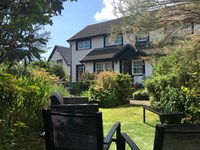
Coastal North Ayrshire Council Cottage
From £605.00 per week at Holidaycottages.co.uk
Corrafeckloch Forest Cottages

From £2695.00 per week at Sykes Holiday Cottages
Luxury Romantic South Ayrshire Council Lodge
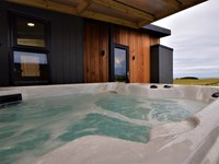
From £618.00 per week at Holidaycottages.co.uk
Coastal North Ayrshire Council Cottage
From £1032.00 per week at Holidaycottages.co.uk
Coastal North Ayrshire Cottage
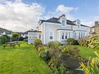
From £773.00 per week at Holidaycottages.co.uk
Honesty Cottage

From £1581.00 per week at Sykes Holiday Cottages
Trump Turnberry Golf Courses (0.4 miles)
The Spa at Turnberry (0.4 miles)
Turnberry Light House (1 miles)
A D Rattray's Whisky Experience & Whisky Shop (2.9 miles)
Culzean Castle and Country Park (3.7 miles)
Girvan Golf Course (4.2 miles)
Brunston Castle Golf Club (4.7 miles)
Crossraguel Abbey (4.8 miles)
Electric Brae (5.8 miles)
All distances are approximate
around 2 miles north-northeast as the seagull flies, around 2 miles by road.
around 3 miles north-northeast as the seagull flies, around 6 miles by road or 4 miles on foot using coastal paths.
around 5 miles south as the seagull flies, around 6 miles by road.
around 5 miles north-northeast as the seagull flies, around 9 miles by road or 6 miles on foot using coastal paths.
around 8 miles north-northeast as the seagull flies, around 11 miles by road.
around 10 miles northeast as the seagull flies, around 14 miles by road.
around 11 miles northeast as the seagull flies, around 15 miles by road.
around 12 miles northeast as the seagull flies, around 15 miles by road.
around 13 miles northeast as the seagull flies, around 16 miles by road.
around 16 miles north-northeast as the seagull flies, around 20 miles by road.
around 17 miles north-northeast as the seagull flies, around 24 miles by road.
around 18 miles north-northeast as the seagull flies, around 25 miles by road.
around 18 miles north-northeast as the seagull flies, around 26 miles by road.
around 21 miles north-northeast as the seagull flies, around 29 miles by road.
around 22 miles north as the seagull flies, around 35 miles by road.
around 23 miles north as the seagull flies, around 36 miles by road.
around 23 miles north as the seagull flies, around 37 miles by road.
around 26 miles north as the seagull flies, around 40 miles by road.
around 28 miles south-southwest as the seagull flies, around 34 miles by road.
around 29 miles south-southwest as the seagull flies, around 36 miles by road.
Location: Turnberry
Location type: Village
OS Grid: NS199053
Coordinates: 55°18'33"N 4°50'18"W
Mapcode: GBR 41.7N6M
What 3 Words: bibs.graphic.firewall
Coordinates and location codes are for an approximate mid-point of the beach, and may not reflect the best access point or the most popular part of the beach.
Country: Scotland
Local Authority: South Ayrshire
Nearest postcode: KA26 9LP
(for sat-nav purposes only, a beach does not have a postal address!)
Important! Beach information is compiled from a variety of different sources and is correct to the best of our knowledge at the time of compilation. However, information may be incorrectly supplied by our sources or go out of date after publication. BritishBeaches.uk makes no warranty as to the accuracy of any information on this page.
(Or après-beach. Or pre-beach. Or, just because you might want stuff)