Approximate Location Map
Use two fingers to pan or zoom the map
Use two fingers to pan or zoom the map
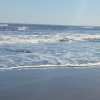
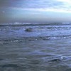
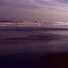
Blackhall Rocks is a nature reserve that features a mix of coastal cliffs, sandy beach, and rocky platforms. The beach has become cleaner over the years, allowing some salt-marsh species to colonise the shore.
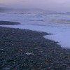
The beach at Blackhall has a complex history, having been heavily impacted by industrial activities in the past. Until 40 years ago, the nearby Blackhall Colliery was linked to the beach by a massive conveyor system that dumped coal spoils into the sea. This resulted in the beach being covered in coal spoils and damage to the ecosystem. However, since then, tens of millions of pounds have been spent cleaning up the beach, and today there is barely a trace of Blackhall's industrial past.
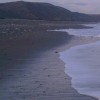
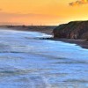
Blackhall Colliery Beach is located near the village of Blackhall Colliery, which lies between Horden and Hartlepool on the A1086. Visitors can explore the beach at low tide, and it is recommended to check the tide times and give yourself a few hours to walk and explore the beach.
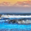
The beach is historically significant due to its association with the coal mining industry. It is also famous for its appearance in the 1971 film "Get Carter," starring Michael Caine, where it was depicted as being covered in coal spoil from the nearby mines. The beach was also featured in the 1992 film "Alien 3."
The beach is dog-friendly all year round, making it a great destination for pet owners. Visitors can enjoy the stunning natural coastline, which is part of the Durham Coast National Nature Reserve.
Blackhall Beach is on the Durham Heritage Coast.
Sand Rock
| Today | |
|---|---|
| Chance of rain | 82% |
| Max temperature | 16°C |
| feels like | 15°C |
| Wind 20mph | |
| Max UV Index |
| Tonight | |
|---|---|
| Chance of rain | 19% |
| Min temperature | 11°C |
| feels like | 10°C |
| Wind 17mph |
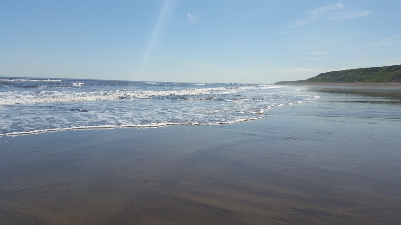
The tide at Blackhall Beach is currently rising. High tide will be at approximately 6:31 AM, and the next low tide will be at approximately 12:55 PM.
![]() Today's air pollution levels are forecast to be Low
Today's air pollution levels are forecast to be Low
There is a small car park behind the beach. Follow Station Road from Blackhall Rocks.
Dogs are allowed
No lifeguard cover at this beach
Water quality not measured here
Rural County Durham Cottage
From £408.00 per week at Holidaycottages.co.uk
No. 12

From £2660.00 per week at Sykes Holiday Cottages
The Wheelhouse

From £1400.00 per week at Sykes Holiday Cottages
Wills House

From £1778.00 per week at Sykes Holiday Cottages
Benjamin Cottage

From £1574.00 per week at Sykes Holiday Cottages
Mead House

From £1609.00 per week at Sykes Holiday Cottages
Tweddle Children's Animal Farm (1.1 miles)
Ward Jackson Park (2.4 miles)
Castle Eden Dene (2.6 miles)
The Durham Fly Fishing Company (3.4 miles)
Little Land Play (4 miles)
Borderlands Travel Ltd (4.3 miles)
Museum of Hartlepool (4.7 miles)
Peterlee Parachute Centre (4.7 miles)
Hartlepool Quay (4.8 miles)
National Museum of the Royal Navy Hartlepool (4.8 miles)
All distances are approximate
just over a mile northwest as the seagull flies, around 2 miles by road.
around 2 miles southeast as the seagull flies, around 2 miles by road.
around 2 miles northwest as the seagull flies, around 3 miles by road.
around 3 miles southeast as the seagull flies, around 3 miles by road.
around 3 miles north-northwest as the seagull flies, around 5 miles by road.
around 4 miles southeast as the seagull flies, around 6 miles by road.
around 6 miles south-southeast as the seagull flies, around 7 miles by road.
around 7 miles north-northwest as the seagull flies, around 13 miles by road or 9 miles on foot using coastal paths.
around 7 miles north-northwest as the seagull flies, around 13 miles by road or 9 miles on foot using coastal paths.
around 7 miles north-northwest as the seagull flies, around 13 miles by road or 9 miles on foot using coastal paths.
around 7 miles south-southeast as the seagull flies, around 8 miles by road.
around 8 miles north-northwest as the seagull flies, around 15 miles by road or 9 miles on foot using coastal paths.
around 8 miles south-southeast as the seagull flies, around 10 miles by road.
around 9 miles north-northwest as the seagull flies, around 14 miles by road or 11 miles on foot using coastal paths.
around 9 miles north-northwest as the seagull flies, around 14 miles by road.
around 10 miles north-northwest as the seagull flies, around 17 miles by road or 13 miles on foot using coastal paths.
around 11 miles north-northwest as the seagull flies, around 17 miles by road or 13 miles on foot using coastal paths.
around 12 miles southeast as the seagull flies, around 27 miles by road.
around 12 miles southeast as the seagull flies, around 27 miles by road.
around 13 miles southeast as the seagull flies, around 28 miles by road.
Location: Blackhall Rocks
Location type: Urban
OS Grid: NZ469394
Coordinates: 54°44'50"N 1°16'19"W
Mapcode: GBR MFKJ.DZ
What 3 Words: teach.drooling.grounded
Coordinates and location codes are for an approximate mid-point of the beach, and may not reflect the best access point or the most popular part of the beach.
Country: England
Local Authority: County Durham
Parish: Monk Hesleden
Nearest postcode: TS27 4AT
(for sat-nav purposes only, a beach does not have a postal address!)
Important! Beach information is compiled from a variety of different sources and is correct to the best of our knowledge at the time of compilation. However, information may be incorrectly supplied by our sources or go out of date after publication. BritishBeaches.uk makes no warranty as to the accuracy of any information on this page.
(Or après-beach. Or pre-beach. Or, just because you might want stuff)
Men's Tops
Weird Fish Fished Branded T-Shirt Ebony Marl Size 5XL

Only £18.75 from Weird Fish