Approximate Location Map
Use two fingers to pan or zoom the map
Use two fingers to pan or zoom the map
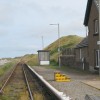
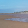
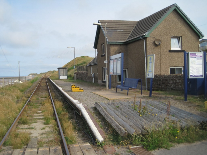
Braystones Beach is situated near the Sellafield nuclear fuel reprocessing and nuclear decommissioning site. The beach is a mix of sand and shingle and is mostly submerged at high tide. Historically, it was a popular holiday destination, with a row of beach bungalows located just above the shoreline. Braystones railway station is located behind these chalets, and a single-track coastal railway runs alongside the beach. Visitors can see the industrial buildings of Sellafield from the beach, with the fells of the nearby Lake District National Park visible in the background. The west-facing beach offers stunning views across the Irish Sea and is a good spot for sunsets.
In comparison to Seascale Beach, also located in Cumbria, Braystones Beach is much smaller and more affected by the tide. Seascale Beach is a popular destination known for its expansive sandy shores and stunning views across the Irish Sea. The beach stretches for miles and features a combination of sandy areas and shingle, providing ample space for beachgoers. At low tide, a vast expanse of clean sand is revealed, making it ideal for various activities such as swimming and beachcombing.
Unlike Seascale Beach, Braystones Beach has limited facilities and activities available. There is no lifeguard service on Braystones Beach, and the beach is not suitable for swimming at high tide due to the submersion of the sand and shingle. However, the beach's unique location and views make it an interesting spot for visitors.
Braystones Beach is adjacent to the Cumbria Coastal Way.
Sand Shingle
| Tonight |  |
|---|---|
| Chance of rain | 89% |
| Min temperature | 16°C |
| feels like | 17°C |
| Wind 22mph |  |
| Tomorrow |
 |
|---|---|
| Chance of rain | 39% |
| Max temperature | 16°C |
| feels like | 17°C |
| Wind 22mph |  |
| Max UV Index |  |
The tide at Braystones Beach is currently falling. Low tide will be at approximately 10:51 PM, and the next high tide will be at approximately 5:00 AM tomorrow.
 Today's air pollution levels are forecast to be Low
 Campsite
Parking available close to the beach.
Dogs are allowed.
No lifeguard cover at this beach

Water quality not measured here
just over a mile northwest as the seagull flies, around 2 miles by road.
around 4 miles southeast as the seagull flies, around 8 miles by road or 4 miles on foot using coastal paths.
around 4 miles northwest as the seagull flies, around 7 miles by road.
around 8 miles southeast as the seagull flies, around 11 miles by road.
around 8 miles north-northwest as the seagull flies, around 11 miles by road.
around 9 miles north as the seagull flies, around 12 miles by road.
around 15 miles north as the seagull flies, around 19 miles by road.
around 16 miles north as the seagull flies, around 20 miles by road.
around 17 miles south-southeast as the seagull flies, around 24 miles by road.
around 19 miles north as the seagull flies, around 23 miles by road.
around 19 miles southeast as the seagull flies, around 26 miles by road.
around 20 miles south-southeast as the seagull flies, around 26 miles by road.
around 22 miles southeast as the seagull flies, around 40 miles by road.
around 22 miles north as the seagull flies, around 27 miles by road.
around 22 miles southeast as the seagull flies, around 44 miles by road.
around 24 miles north as the seagull flies, around 29 miles by road.
around 24 miles south-southeast as the seagull flies, around 49 miles by road.
around 25 miles south-southeast as the seagull flies, around 45 miles by road.
around 26 miles south-southeast as the seagull flies, around 47 miles by road.
around 26 miles south-southeast as the seagull flies, around 48 miles by road.
Location: Braystones
Location type: Village
OS Grid: NY000059
Coordinates: 54°26'20"N 3°32'31"W
Mapcode: GBR 3KP3.YJ
What 3 Words: highways.aimless.jots
Coordinates and location codes are for an approximate mid-point of the beach, and may not reflect the best access point or the most popular part of the beach.
County: Cumbria
Country: England
Local Authority: Copeland
Parish: Lowside Quarter
Nearest postcode: CA21 2YL
(for sat-nav purposes only, a beach does not have a postal address!)
Important! Beach information is compiled from a variety of different sources and is correct to the best of our knowledge at the time of compilation. However, information may be incorrectly supplied by our sources or go out of date after publication. BritishBeaches.uk makes no warranty as to the accuracy of any information on this page.