Approximate Location Map
Use two fingers to pan or zoom the map
Use two fingers to pan or zoom the map
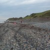
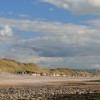
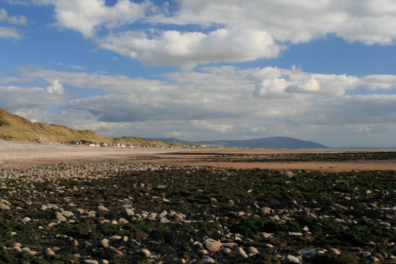
Nethertown beach is mainly composed of shingle, with a broad strip of sand exposed at low tide. The beach is backed by the small village of Nethertown and the single-track coastal railway line, with grassy dunes separating the railway track from the beach. A scattering of chalets and beach bungalows can be found between the railway track and the beach. Visitors to the beach can enjoy views over the Irish Sea and the Sellafield nuclear reprocessing plant to the south, as well as the fells of the Lake District in the distance. The west-facing beach is also known for its good sunsets.
During the Second World War, the nearby village of Nethertown was home to an anti-aircraft training camp. Today, there are a number of caravan parks along this stretch of the coast, offering accommodation options for visitors.
While Nethertown Beach itself is a relatively quiet destination, there are other attractions in the area that are worth visiting. The popular seaside resort of St Bees, located in Cumbria, is home to a mile-long rural sandy beach that is easily accessible from the village centre. The beach is ideal for families during the summer months, with plenty of opportunities for building sandcastles, exploring rock pools, and paddling in the sea. The area is also popular with walkers and nature lovers, who come to stroll along the wide promenade or begin the Wainwright 'coast to coast' walk. Visitors can also play a round of golf at the St Bees Golf course, which offers stunning sea views.
St Bees beach is dog-friendly all year round, making it one of the best beaches for dogs in Cumbria. With plenty of space to run around, dogs can enjoy the beach and the surrounding countryside.
Nethertown Beach is adjacent to the Cumbria Coastal Way.
Sand Shingle
| Tonight |  |
|---|---|
| Chance of rain | 94% |
| Min temperature | 16°C |
| feels like | 17°C |
| Wind 22mph |  |
| Tomorrow |
 |
|---|---|
| Chance of rain | 42% |
| Max temperature | 16°C |
| feels like | 17°C |
| Wind 23mph |  |
| Max UV Index |  |
The tide at Nethertown Beach is currently falling. Low tide will be at approximately 10:51 PM, and the next high tide will be at approximately 5:00 AM tomorrow.
 Today's air pollution levels are forecast to be Low
 Campsite
Parking is adjacent to the beach.
Dogs are allowed.
No lifeguard cover at this beach

Water quality not measured here
just over a mile southeast as the seagull flies, around 2 miles by road.
around 3 miles northwest as the seagull flies, around 5 miles by road.
around 5 miles southeast as the seagull flies, around 10 miles by road or 6 miles on foot using coastal paths.
around 7 miles north as the seagull flies, around 9 miles by road.
around 8 miles north as the seagull flies, around 12 miles by road or 9 miles on foot using coastal paths.
around 9 miles southeast as the seagull flies, around 13 miles by road.
around 14 miles north as the seagull flies, around 19 miles by road.
around 15 miles north as the seagull flies, around 20 miles by road.
around 18 miles north as the seagull flies, around 23 miles by road.
around 18 miles south-southeast as the seagull flies, around 25 miles by road.
around 20 miles southeast as the seagull flies, around 28 miles by road.
around 21 miles south-southeast as the seagull flies, around 28 miles by road.
around 21 miles north-northeast as the seagull flies, around 27 miles by road.
around 23 miles north-northeast as the seagull flies, around 29 miles by road.
around 23 miles southeast as the seagull flies, around 42 miles by road.
around 24 miles southeast as the seagull flies, around 45 miles by road.
around 26 miles south-southeast as the seagull flies, around 50 miles by road.
around 26 miles south-southeast as the seagull flies, around 47 miles by road.
around 27 miles south-southeast as the seagull flies, around 49 miles by road.
around 28 miles south-southeast as the seagull flies, around 49 miles by road.
Location: Nethertown
Location type: Village
OS Grid: NX988073
Coordinates: 54°27'4"N 3°33'43"W
Mapcode: GBR 3JKZ.M2
What 3 Words: scoop.condense.duplicity
Coordinates and location codes are for an approximate mid-point of the beach, and may not reflect the best access point or the most popular part of the beach.
County: Cumbria
Country: England
Local Authority: Copeland
Parish: Lowside Quarter
Nearest postcode: CA22 2UN
(for sat-nav purposes only, a beach does not have a postal address!)
Important! Beach information is compiled from a variety of different sources and is correct to the best of our knowledge at the time of compilation. However, information may be incorrectly supplied by our sources or go out of date after publication. BritishBeaches.uk makes no warranty as to the accuracy of any information on this page.