Approximate Location Map
Use two fingers to pan or zoom the map
Use two fingers to pan or zoom the map
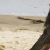
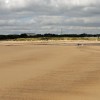
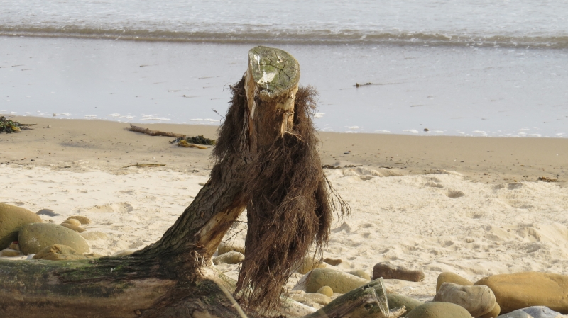
Cambois North Beach is a long strip of sand that stretches south towards Blyth, bordered to the north by the Wansbeck estuary. The beach is situated between the Blyth and Wansbeck estuaries and is backed by dunes at its southern end. The coastline here is characterised by a long stretch of sand, backed by rocks and grassy dunes, which extends from the River Wansbeck estuary to the north to Blyth Harbour to the south.
The beach is utilised by various groups, including walkers, anglers, and the occasional surfer. However, the area has experienced issues with litter and debris washing up along the coastline. In response, volunteers participate in organised beach clean-ups to help maintain the area's cleanliness.
Sand
| Today | |
|---|---|
| Chance of rain | 87% |
| Max temperature | 15°C |
| feels like | 15°C |
| Wind 20mph | |
| Max UV Index |
| Tonight | |
|---|---|
| Chance of rain | 21% |
| Min temperature | 11°C |
| feels like | 11°C |
| Wind 19mph |
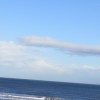
The tide at Cambois North Beach is currently rising. High tide will be at approximately 6:21 AM, and the next low tide will be at approximately 12:47 PM.
![]() Today's air pollution levels are forecast to be Low
Today's air pollution levels are forecast to be Low
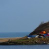
Car parks available next to the beach.
Dogs are allowed.
No lifeguard cover at this beach
Water quality not measured here
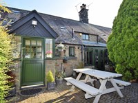
The Mistal

From £2024.00 per week at Sykes Holiday Cottages
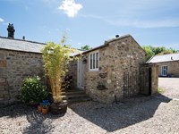
The Byre at Warkworth

From £2618.00 per week at Sykes Holiday Cottages
Bay View

From £1825.00 per week at Sykes Holiday Cottages
Rural Tyne And Wear Cottage
From £567.00 per week at Holidaycottages.co.uk
Romantic Rural Northumberland Cottage
From £376.00 per week at Holidaycottages.co.uk
Rose Cottage

From £2151.00 per week at Sykes Holiday Cottages
Blyth Battery (1.5 miles)
Phoenix Theatre Blyth (1.8 miles)
Ridley Park (1.9 miles)
The Couple Statue (2.4 miles)
Newbiggin Maritime Centre (2.5 miles)
Saint Bartholomew's Church (2.6 miles)
Woodhorn Museum (2.9 miles)
Woodhorn Narrow Gauge Railway (3 miles)
Queen Elizabeth II Country Park (3.7 miles)
All distances are approximate
less than a mile south-southeast as the seagull flies, less than a mile by road.
around 2 miles north as the seagull flies, around 5 miles by road or 3 miles on foot using coastal paths.
around 3 miles north-northeast as the seagull flies, around 6 miles by road or 4 miles on foot using coastal paths.
around 3 miles south-southeast as the seagull flies, around 7 miles by road.
around 3 miles north-northeast as the seagull flies, around 6 miles by road or 5 miles on foot using coastal paths.
around 4 miles north as the seagull flies, around 7 miles by road or 5 miles on foot using coastal paths.
around 5 miles south-southeast as the seagull flies, around 11 miles by road or 9 miles on foot using coastal paths.
around 5 miles north as the seagull flies, around 9 miles by road or 7 miles on foot using coastal paths.
around 6 miles north as the seagull flies, around 11 miles by road or 8 miles on foot using coastal paths.
around 6 miles north as the seagull flies, around 11 miles by road.
around 8 miles south-southeast as the seagull flies, around 14 miles by road.
around 8 miles north-northwest as the seagull flies, around 13 miles by road or 10 miles on foot using coastal paths.
around 9 miles south-southeast as the seagull flies, around 17 miles by road or 13 miles on foot using coastal paths.
around 9 miles south-southeast as the seagull flies, around 17 miles by road or 14 miles on foot using coastal paths.
around 10 miles south-southeast as the seagull flies, around 17 miles by road.
around 10 miles north as the seagull flies, around 17 miles by road or 13 miles on foot using coastal paths.
around 10 miles south-southeast as the seagull flies, around 17 miles by road.
around 12 miles north as the seagull flies, around 18 miles by road.
around 14 miles north-northwest as the seagull flies, around 20 miles by road.
around 17 miles north-northwest as the seagull flies, around 23 miles by road.
Location: Cambois
Location type: Village
OS Grid: NZ306840
Coordinates: 55°8'59"N 1°31'16"W
Mapcode: GBR K8TW.FP
What 3 Words: crush.groups.dish
Coordinates and location codes are for an approximate mid-point of the beach, and may not reflect the best access point or the most popular part of the beach.
Country: England
Local Authority: Northumberland
Parish: East Bedlington
Nearest postcode: NE24 1RB
(for sat-nav purposes only, a beach does not have a postal address!)
Important! Beach information is compiled from a variety of different sources and is correct to the best of our knowledge at the time of compilation. However, information may be incorrectly supplied by our sources or go out of date after publication. BritishBeaches.uk makes no warranty as to the accuracy of any information on this page.
(Or après-beach. Or pre-beach. Or, just because you might want stuff)
Men's Tops
Weird Fish Beye 1/4 Zip Grid Fleece Hot Coral Size 20

Only £45.00 from Weird Fish