Approximate Location Map
Use two fingers to pan or zoom the map
Use two fingers to pan or zoom the map
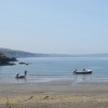
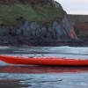
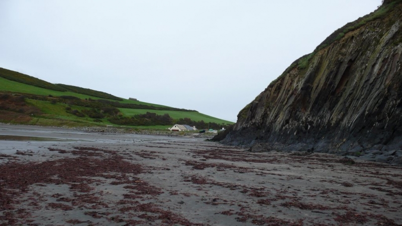
Pwllgwaelod Beach is a small sandy beach encircled by cliffs, providing a picturesque outlook towards Fishguard Harbour. The cliffs offer some protection from the wind, and at low tide, a good stretch of sand is available. The beach serves as one of the starting points for a three-mile trek along the Pembrokeshire National Park Coastal Footpath, which follows the coast around to Dinas Head.
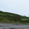
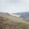
The coastal walk takes you up a steep cliff rising to 465 feet, passing an array of pretty flora and fauna along the way. From this vantage point, you can take in the views over Fishguard Bay from a different perspective. The area is also renowned for its diverse birdlife, with species such as chough, fulmar, and peregrine falcon commonly spotted.
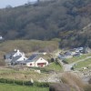
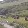
The beach is located on the south-west side of Dinas Island, looking out over Fishguard Bay. Although slightly off the beaten track, it is a great spot for a day out, with a nearby pub for refreshments, a public car park, and toilets available.
Pwllgwaelod Beach is adjacent to the Pembrokeshire Coast Path and the Wales Coast Path.
Bay Sand Rock
| Today | |
|---|---|
| Chance of rain | 100% |
| Max temperature | 15°C |
| feels like | 15°C |
| Wind 23mph | |
| Max UV Index |
| Tonight | |
|---|---|
| Chance of rain | 28% |
| Min temperature | 10°C |
| feels like | 11°C |
| Wind 22mph |
The tide at Pwllgwaelod Beach is currently falling. Low tide will be at approximately 4:40 AM, and the next high tide will be at approximately 10:23 AM.
![]() Today's air pollution levels are forecast to be Low
Today's air pollution levels are forecast to be Low
Parking is next to the beach.
Dogs are allowed.
No lifeguard cover at this beach
Water quality not measured here
Panteurig Farmhouse

From £2071.00 per week at Sykes Holiday Cottages
Rural Dyfed Apartment
From £463.00 per week at Holidaycottages.co.uk
Morfa Isaf Cottage

From £1529.00 per week at Sykes Holiday Cottages
Copybush Cottage

From £7066.00 per week at Sykes Holiday Cottages
Potters Barn

From £2598.00 per week at Sykes Holiday Cottages
Ty Cerrig

From £3035.00 per week at Sykes Holiday Cottages
Dyffryn Fernant Gardens (1.9 miles)
Kayak-King (3.1 miles)
The Last Invasion Tapestry Gallery (3.4 miles)
Theatr Gwaun (3.4 miles)
RockUp-Climbing (3.6 miles)
Ocean Lab (3.7 miles)
Bessies (3.9 miles)
Bluestone Brewing Company Ltd (4.9 miles)
Yet-Y-Gors Fishery and Campsite (5.3 miles)
All distances are approximate
less than a mile east as the seagull flies, just over a mile by road or less than a mile on foot using coastal paths.
around 3 miles east as the seagull flies, around 4 miles by road.
around 3 miles east as the seagull flies, around 7 miles by road.
around 4 miles west-southwest as the seagull flies, around 7 miles by road.
around 4 miles west-southwest as the seagull flies, around 7 miles by road.
around 8 miles west-southwest as the seagull flies, around 12 miles by road.
around 10 miles west-southwest as the seagull flies, around 14 miles by road.
around 11 miles east-northeast as the seagull flies, around 15 miles by road.
around 11 miles east-northeast as the seagull flies, around 14 miles by road.
around 11 miles east-northeast as the seagull flies, around 18 miles by road.
around 12 miles northeast as the seagull flies, around 19 miles by road.
around 14 miles west-southwest as the seagull flies, around 17 miles by road.
around 14 miles northeast as the seagull flies, around 20 miles by road.
around 14 miles west-southwest as the seagull flies, around 17 miles by road.
around 14 miles west-southwest as the seagull flies, around 17 miles by road.
around 15 miles southwest as the seagull flies, around 18 miles by road.
around 16 miles south-southwest as the seagull flies, around 21 miles by road.
around 17 miles south-southwest as the seagull flies, around 22 miles by road.
around 17 miles east-northeast as the seagull flies, around 22 miles by road.
around 18 miles southwest as the seagull flies, around 21 miles by road.
Location: Bryn-henllan,
Location type: Village
OS Grid: SN004398
Coordinates: 52°1'17"N 4°54'36"W
Mapcode: GBR CN.GW6M
What 3 Words: quoted.mirror.whoever
Coordinates and location codes are for an approximate mid-point of the beach, and may not reflect the best access point or the most popular part of the beach.
Country: Wales
Local Authority: Pembrokeshire
Parish: Dinas Cross
Nearest postcode: SA42 0SE
(for sat-nav purposes only, a beach does not have a postal address!)
Important! Beach information is compiled from a variety of different sources and is correct to the best of our knowledge at the time of compilation. However, information may be incorrectly supplied by our sources or go out of date after publication. BritishBeaches.uk makes no warranty as to the accuracy of any information on this page.
(Or après-beach. Or pre-beach. Or, just because you might want stuff)
Men's Tops
Weird Fish Cruiser 1/4 Zip Macaroni Sweatshirt Antique Moss Size 2XL

Only £56.25 from Weird Fish