Approximate Location Map
Use two fingers to pan or zoom the map
Use two fingers to pan or zoom the map
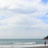
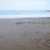
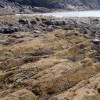
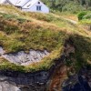
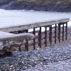
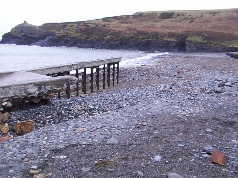
Abereiddy Beach is a small, sheltered beach, less than 100 meters wide, composed of sand and shingle. The beach is surrounded by wild coastline and headlands, offering excellent views. The pebbles and extraordinarily dark sand are made of pounded grey slate, which gives the water in the nearby 'Blue Lagoon' a brilliant deep blue colour.
The beach is popular with tourists and residents alike, especially with coasteerers, divers, and surfers. It also provides an ideal location for bathing, kayaking, and fishing. At low tide, rockpools can be found along the beach, offering entertainment for children to explore and discover marine wildlife. The Pembrokeshire Coastal Path passes the beach, making it a popular spot for walkers.
A large car park adjoins the beach, and public toilets are available from Easter to October half-term. The beach is located within Castell Coch Cliffs and Llanfryn Quarries Site of Special Scientific Interest (SSSI) and Trwyncastell Cliffs and the Blue Lagoon SSSI, with the bathing water itself being contained within Pembrokeshire marine Special Area of Conservation (mSAC). There are no other facilities at the beach itself, but there are places to stay in the nearby hamlets and villages.
The Blue Lagoon, a large disused slate quarry, is located to the north of the beach and is now filled with seawater. The lagoon is a popular spot for clubs to organise jumps from the rocks, and spectators can watch the spectacle. A short walk from the beach, the Blue Lagoon offers stunning views and a unique experience.
Abereiddy Beach is adjacent to the Pembrokeshire Coast Path and the Wales Coast Path.
Sand Pebbles
| Today | |
|---|---|
| Chance of rain | 100% |
| Max temperature | 14°C |
| feels like | 14°C |
| Wind 23mph | |
| Max UV Index |
| Tonight | |
|---|---|
| Chance of rain | % |
| Min temperature | 11°C |
| feels like | 11°C |
| Wind 24mph |
The tide at Abereiddy Beach is currently falling. Low tide will be at approximately 4:05 AM, and the next high tide will be at approximately 10:02 AM.
![]() Today's air pollution levels are forecast to be Low
Today's air pollution levels are forecast to be Low
Car parking free next to the beach.
Dogs are allowed
Cleaned daily during the summer
No lifeguard cover at this beach
![]()
Excellent water quality
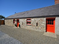
Garden Cottage

From £1652.00 per week at Sykes Holiday Cottages
Meadowlands

From £2125.00 per week at Sykes Holiday Cottages
Cheriton Villa

From £2061.00 per week at Sykes Holiday Cottages
Heather Cottage

From £2294.00 per week at Sykes Holiday Cottages
Romantic Rural Dyfed Cottage
From £419.00 per week at Holidaycottages.co.uk
Tlws Bach

From £2163.00 per week at Sykes Holiday Cottages
Celtic Quest Coasteering (0.1 miles)
Porthgain Harbour (1.4 miles)
St. Davids Escape Room (1.7 miles)
Solva Woollen Mill (3.4 miles)
Dr Beynon's Bug Farm (3.4 miles)
The Real Adventure Company (3.8 miles)
Solva (4.1 miles)
Wales Coastal Path (4.4 miles)
Dragon Activity Guides (4.5 miles)
Voyages of Discovery (Ramsey Island) (4.5 miles)
All distances are approximate
less than a mile north-northwest as the seagull flies, less than a mile by road.
less than a mile northeast as the seagull flies, less than a mile by road.
around 4 miles east-northeast as the seagull flies, around 5 miles by road.
around 5 miles southwest as the seagull flies, around 6 miles by road.
around 5 miles south-southwest as the seagull flies, around 7 miles by road.
around 5 miles southwest as the seagull flies, around 7 miles by road.
around 6 miles south-southwest as the seagull flies, around 6 miles by road.
around 6 miles east-northeast as the seagull flies, around 11 miles by road or 7 miles on foot using coastal paths.
around 6 miles south-southeast as the seagull flies, around 8 miles by road.
around 9 miles south-southeast as the seagull flies, around 12 miles by road.
around 10 miles south-southeast as the seagull flies, around 14 miles by road.
around 10 miles east-northeast as the seagull flies, around 12 miles by road.
around 10 miles east-northeast as the seagull flies, around 12 miles by road.
around 12 miles south-southeast as the seagull flies, around 16 miles by road.
around 12 miles south-southeast as the seagull flies, around 16 miles by road.
around 13 miles south as the seagull flies, around 27 miles by road or 19 miles on foot using coastal paths.
around 14 miles south as the seagull flies, around 31 miles by road or 23 miles on foot using coastal paths.
around 14 miles east-northeast as the seagull flies, around 17 miles by road.
around 15 miles east-northeast as the seagull flies, around 17 miles by road.
around 15 miles south as the seagull flies, around 29 miles by road or 22 miles on foot using coastal paths.
Location: Cyffredin
Location type: Rural
Nearest village: Porthgain
OS Grid: SM796312
Coordinates: 51°56'9"N 5°12'24"W
Mapcode: GBR C8.N74D
What 3 Words: steeped.brotherly.kinder
Coordinates and location codes are for an approximate mid-point of the beach, and may not reflect the best access point or the most popular part of the beach.
Country: Wales
Local Authority: Pembrokeshire
Parish: Llanrhian
Nearest postcode: SA62 6DT
(for sat-nav purposes only, a beach does not have a postal address!)
Important! Beach information is compiled from a variety of different sources and is correct to the best of our knowledge at the time of compilation. However, information may be incorrectly supplied by our sources or go out of date after publication. BritishBeaches.uk makes no warranty as to the accuracy of any information on this page.
(Or après-beach. Or pre-beach. Or, just because you might want stuff)
Women's Outerwear
Weird Fish Langtree Lightweight Showerproof Padded Gilet Navy Size L

Only £48.75 from Weird Fish