Approximate Location Map
Use two fingers to pan or zoom the map
Use two fingers to pan or zoom the map
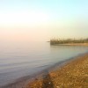
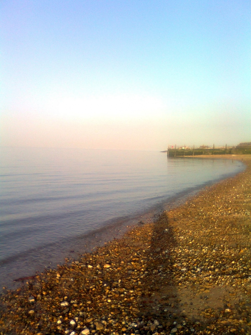
Sheerness Beach is situated on the northern coast of the Isle of Sheppey, where the rivers Thames and Medway meet the North Sea. The beach is a gently sloping shingle beach, backed by a large sea defence wall, which forms the promenade. The beach has a mix of shingle and sand, and at low tide, crabs, shrimps, and other sea creatures may be found in the pools that become exposed. A number of groynes stretch out into the sea.
The beach is backed by a substantial sea wall, which forms a promenade, used by walkers and cyclists. Along the promenade, there are benches and steps leading down to the beach at regular intervals. However, access for those with mobility problems may be difficult. The beach is kept clean and has regularly been awarded Blue Flag status. A children's play area with a sandpit and a skateboard park can be found close by.
Sheerness Beach is a popular destination for families, particularly during the summer months, when crabbers and shell hunters enjoy foraging among the shingle at low tide. The beach is also a great place to watch cargo vessels sailing up and down the busy shipping lanes. Although there are no facilities at the beach, a McDonald's and a branch of Tesco are both a short walk away, and the town's shops, cafes, and restaurants are within easy reach of the beach.
Visitors to Sheerness Beach can also take the scenic coastal 10km circular cycle route around Sheerness, which is ideal for a family activity and a great way to explore the area.
Sheerness Beach is adjacent to the Kent Coastline Walk.
Sand Shingle Pebbles Rock
| Today | |
|---|---|
| Chance of rain | 76% |
| Max temperature | 17°C |
| feels like | 17°C |
| Wind 21mph | |
| Max UV Index |
| Tonight | |
|---|---|
| Chance of rain | 46% |
| Min temperature | 12°C |
| feels like | 13°C |
| Wind 16mph |
The tide at Sheerness Beach is currently falling. Low tide will be at approximately 9:31 AM, and the next high tide will be at approximately 3:40 PM.
![]() Today's air pollution levels are forecast to be Low
Today's air pollution levels are forecast to be Low
Parking off of Beach Street, behind sea wall.
Dogs not allowed on certain areas May 1st to September 30th.
The beach is cleaned daily all year round.
Daily - 9th July - 4th September
Weekends - 21st May - 3rd July
![]()
![]()
![]()
Excellent water quality
Romantic Stelling Minnis House Cottage
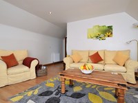
From £571.00 per week at Holidaycottages.co.uk
4 Fishermans Wharf

From £2888.00 per week at Sykes Holiday Cottages
Haymens Wharf

From £1807.00 per week at Sykes Holiday Cottages
Brew Cottage

From £1859.00 per week at Sykes Holiday Cottages
Romantic Kent House

From £1055.00 per week at Holidaycottages.co.uk
Kent Cottage

From £936.00 per week at Holidaycottages.co.uk
Blue Town Heritage Centre (0.4 miles)
Barton's Point Coastal Park (0.5 miles)
Whelan's (0.9 miles)
Elmley National Nature Reserve (2.1 miles)
Minster Abbey Gatehouse Museum (2.1 miles)
Admiral's Arm Micropub (2.1 miles)
The Beano Cafe (440 yards)
All distances are approximate
around 2 miles east-southeast as the seagull flies, around 2 miles by road.
around 6 miles west-northwest as the seagull flies, around 31 miles by road.
around 7 miles east-southeast as the seagull flies, around 8 miles by road.
around 12 miles east-southeast as the seagull flies, around 31 miles by road or 24 miles on foot using coastal paths.
around 13 miles east-southeast as the seagull flies, around 32 miles by road or 26 miles on foot using coastal paths.
around 15 miles east-southeast as the seagull flies, around 34 miles by road.
around 16 miles east-southeast as the seagull flies, around 35 miles by road.
around 17 miles east-southeast as the seagull flies, around 36 miles by road.
around 17 miles east-southeast as the seagull flies, around 36 miles by road.
around 19 miles east-southeast as the seagull flies, around 43 miles by road or 33 miles on foot using coastal paths.
around 23 miles east as the seagull flies, around 44 miles by road.
around 25 miles east as the seagull flies, around 44 miles by road.
around 25 miles east as the seagull flies, around 45 miles by road.
around 26 miles east as the seagull flies, around 46 miles by road.
around 26 miles east as the seagull flies, around 47 miles by road.
around 27 miles east as the seagull flies, around 47 miles by road.
around 27 miles east as the seagull flies, around 48 miles by road.
around 28 miles east as the seagull flies, around 48 miles by road.
around 29 miles east-southeast as the seagull flies, around 50 miles by road.
around 29 miles east-southeast as the seagull flies, around 48 miles by road.
Location: Marine Town, Sheerness
Location type: Urban
OS Grid: TQ926749
Coordinates: 51°26'27"N 0°46'16"E
Mapcode: GBR RS2.PR5
What 3 Words: notion.shallower.camp
Coordinates and location codes are for an approximate mid-point of the beach, and may not reflect the best access point or the most popular part of the beach.
County: Kent
Country: England
Local Authority: Swale
Nearest postcode: ME12 2AW
(for sat-nav purposes only, a beach does not have a postal address!)
Important! Beach information is compiled from a variety of different sources and is correct to the best of our knowledge at the time of compilation. However, information may be incorrectly supplied by our sources or go out of date after publication. BritishBeaches.uk makes no warranty as to the accuracy of any information on this page.
(Or après-beach. Or pre-beach. Or, just because you might want stuff)
Men's Tops
Weird Fish Beye 1/4 Zip Grid Fleece Ecru Size 14

Only £45.00 from Weird Fish