Approximate Location Map
Use two fingers to pan or zoom the map
Use two fingers to pan or zoom the map
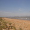
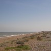
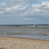
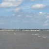
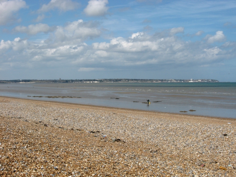
Sandwich Bay is situated on the East coast of Kent, between Ramsgate and Deal. The beach is a long, sandy and shingle stretch, backed by salt marshes, coastal sand dunes, and private estates. The northern end of the beach is bordered by the River Stour and features a nature reserve, the Sandwich & Pegwell Bay National Nature Reserve.
The beach is mostly shingle at high tide, with patches of sand revealed when the tide goes out. It's a popular spot for walkers, nature lovers, and those seeking a peaceful escape. Visitors can enjoy activities such as birdwatching, fishing, paddleboarding, and kayaking, although swimming is not recommended due to the steep shingle banks and occasional strong currents. The beach is also home to the Sandwich Bay Sailing & Water Ski Club, which offers members access to various water sports.
Access to the beach is through a private toll road, which costs a small fee for vehicles (from £7). Alternatively, visitors can walk or cycle in for free via coastal paths, including the Saxon Shore Way. There are no beachside facilities directly on the beach, so visitors should come prepared with their own food, water, and any other supplies.
The northern end of the beach is often used by naturists, although there have been reports of some friction with golf club members. Dogs are welcome on the beach all year round, making Sandwich Bay a favourite among locals who want a long, open space for walks.
The area is steeped in history, with the nearby town of Sandwich being one of England's best-preserved medieval towns, and Richborough Roman Fort offering a fascinating look at the area's past.
Sandwich Bay is adjacent to the Kent Coastline Walk.
Sand Mud
| Today | |
|---|---|
| Chance of rain | 74% |
| Max temperature | 18°C |
| feels like | 18°C |
| Wind 24mph | |
| Max UV Index |
| Tonight | |
|---|---|
| Chance of rain | 58% |
| Min temperature | 11°C |
| feels like | 13°C |
| Wind 17mph |
The tide at Sandwich Bay is currently falling. Low tide will be at approximately 10:31 AM, and the next high tide will be at approximately 2:27 PM.
![]() Today's air pollution levels are forecast to be Low
Today's air pollution levels are forecast to be Low
Parking available near the reserve and towards the north of the beach. The reserve and visitor centre are wheelchair accessible.
Dogs not allowed.
No lifeguard cover at this beach
![]()
Excellent water quality
Lodesman Cottage

From £413.00 per week at Rural Retreats
Kent House

From £657.00 per week at Holidaycottages.co.uk
Chalet 58 - The Beach House

From £2338.00 per week at Sykes Holiday Cottages
Coast Guard House

From £6890.00 per week at Sykes Holiday Cottages
Romantic Coastal Kent House

From £1223.00 per week at Holidaycottages.co.uk
Whitstable Bay Getaway

From £2120.00 per week at Sykes Holiday Cottages
The Salutation Gardens (1.6 miles)
The Guildhall Museum (1.9 miles)
Richborough Roman Fort and Amphitheatre (2.4 miles)
Sandwich and Pegwell Bay National Nature Reserve (3.3 miles)
The Grange (3.5 miles)
Shrine of St Augustine (3.5 miles)
Sailors Church (3.7 miles)
Ramsgate Royal Harbour & Marina (3.7 miles)
Rib Request - Day Tours (3.9 miles)
Deal Maritime & Local History Museum (4 miles)
All distances are approximate
around 3 miles north-northeast as the seagull flies, around 11 miles by road or 8 miles on foot using coastal paths.
around 4 miles north-northeast as the seagull flies, around 11 miles by road.
around 4 miles south-southeast as the seagull flies, around 5 miles by road.
around 6 miles north-northeast as the seagull flies, around 13 miles by road.
around 6 miles north-northeast as the seagull flies, around 14 miles by road.
around 7 miles south as the seagull flies, around 8 miles by road.
around 7 miles north as the seagull flies, around 14 miles by road.
around 7 miles north-northeast as the seagull flies, around 14 miles by road.
around 7 miles north as the seagull flies, around 13 miles by road.
around 7 miles north-northwest as the seagull flies, around 14 miles by road.
around 7 miles north-northwest as the seagull flies, around 14 miles by road.
around 8 miles north as the seagull flies, around 14 miles by road.
around 8 miles north as the seagull flies, around 14 miles by road.
around 8 miles north as the seagull flies, around 14 miles by road.
around 8 miles north-northeast as the seagull flies, around 14 miles by road.
around 8 miles north-northwest as the seagull flies, around 13 miles by road.
around 9 miles south as the seagull flies, around 15 miles by road or 10 miles on foot using coastal paths.
around 10 miles northwest as the seagull flies, around 17 miles by road.
around 11 miles south-southwest as the seagull flies, around 16 miles by road.
around 12 miles west-northwest as the seagull flies, around 19 miles by road.
Location: Sandwich Bay Estate
Location type: Village
OS Grid: TR358590
Coordinates: 51°16'53"N 1°22'51"E
Mapcode: GBR X14.MXM
What 3 Words: remodels.huddling.closets
Coordinates and location codes are for an approximate mid-point of the beach, and may not reflect the best access point or the most popular part of the beach.
County: Kent
Country: England
Local Authority: Dover
Parish: Worth
Nearest postcode: CT13 9QB
(for sat-nav purposes only, a beach does not have a postal address!)
Important! Beach information is compiled from a variety of different sources and is correct to the best of our knowledge at the time of compilation. However, information may be incorrectly supplied by our sources or go out of date after publication. BritishBeaches.uk makes no warranty as to the accuracy of any information on this page.
(Or après-beach. Or pre-beach. Or, just because you might want stuff)
Men's Tops
Weird Fish Franchises Graphic Full Zip Hoodie Green Ivy Size 10

Only £33.00 from Weird Fish