Approximate Location Map
Use two fingers to pan or zoom the map
Use two fingers to pan or zoom the map
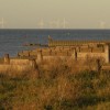
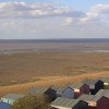
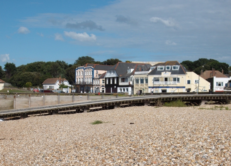
Whitstable West Beach is a long stretch of shingle beach, approximately one mile in length, situated in the seaside town of Whitstable. The beach is intersected by wooden groynes and affords plenty of shallow water as the tide drops, making it a popular spot for water sports enthusiasts.
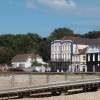
The beach is owned by the Whitstable Oyster Company and offers a good range of local shops, restaurants, and a small harbour from which a local shellfishing fleet operates. Visitors can enjoy a pint and lunch at the Neptune pub, which is situated virtually on the beach. There are also other places to grab a bite to eat along the beach, including the Whitstable Oyster Company restaurant.
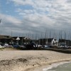
Whitstable West Beach is popular for windsurfing and sailing, with the Whitstable Yacht Club located at the northern end of the beach. The town also hosts the annual Oyster Festival in July, celebrating its famous oysters. Visitors can enjoy long walks along the beach, take in the sunset, and explore the varied landscape created by the wooden groynes.
Please note that a large part of Whitstable beach is privately owned by the Whitstable Oyster Fishery company, and although the public use the beach, access is by permission of the oyster company to allow them to restrict access for their commercial activities. Any queries should be directed to the Oyster Company.
Whitstable West Beach is dog friendly, with ample space for dogs to run and play. The beach is also home to Cushing's View, named after the actor and famous Whitstable resident, Peter Cushing.
Whitstable West Beach is adjacent to the Kent Coastline Walk.
Shingle
| Today | |
|---|---|
| Chance of rain | 95% |
| Max temperature | 17°C |
| feels like | 17°C |
| Wind 22mph | |
| Max UV Index |
| Tonight | |
|---|---|
| Chance of rain | 44% |
| Min temperature | 11°C |
| feels like | 13°C |
| Wind 16mph |
The tide at Whitstable West Beach is currently falling. Low tide will be at approximately 9:45 AM, and the next high tide will be at approximately 3:56 PM.
![]() Today's air pollution levels are forecast to be Low
Today's air pollution levels are forecast to be Low
Parking available off Island Wall.
Dogs are allowed.
No lifeguard cover at this beach
Excellent water quality
Kent Apartment
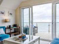
From £1028.00 per week at Holidaycottages.co.uk
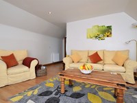
Whitstable Bay Getaway

From £2120.00 per week at Sykes Holiday Cottages
WEST LODGE

From £3053.00 per week at Sykes Holiday Cottages
Quirky Kent Cottage

From £1019.00 per week at Holidaycottages.co.uk
Smallcroft

From £1857.00 per week at Sykes Holiday Cottages
Romantic Stelling Minnis House Cottage
From £571.00 per week at Holidaycottages.co.uk
Whitstable SUP (0.2 miles)
Whitstable Town Centre (0.5 miles)
The Black Dog (0.6 miles)
Playhouse Theatre Whitstable (0.6 miles)
Whitstable Harbour (0.7 miles)
Tankerton Slopes (1.4 miles)
The Tankerton Arms (1.5 miles)
Birdies (380 yards)
Harbour Street Tapas (340 yards)
All distances are approximate
around 2 miles east-northeast as the seagull flies, around 2 miles by road.
around 4 miles east-northeast as the seagull flies, around 5 miles by road.
around 5 miles east-northeast as the seagull flies, around 6 miles by road.
around 5 miles northwest as the seagull flies, around 35 miles by road.
around 6 miles east-northeast as the seagull flies, around 7 miles by road.
around 6 miles east-northeast as the seagull flies, around 8 miles by road.
around 8 miles east-northeast as the seagull flies, around 14 miles by road or 9 miles on foot using coastal paths.
around 11 miles west-northwest as the seagull flies, around 30 miles by road or 23 miles on foot using coastal paths.
around 12 miles east as the seagull flies, around 15 miles by road.
around 12 miles west-northwest as the seagull flies, around 31 miles by road or 24 miles on foot using coastal paths.
around 14 miles east as the seagull flies, around 15 miles by road.
around 14 miles east as the seagull flies, around 16 miles by road.
around 15 miles east as the seagull flies, around 18 miles by road.
around 16 miles east as the seagull flies, around 18 miles by road.
around 16 miles east as the seagull flies, around 19 miles by road.
around 17 miles east-southeast as the seagull flies, around 24 miles by road.
around 17 miles east as the seagull flies, around 19 miles by road.
around 17 miles east as the seagull flies, around 19 miles by road.
around 17 miles east as the seagull flies, around 19 miles by road.
around 18 miles east as the seagull flies, around 20 miles by road.
Location: Lower Island, Whitstable
Location type: Urban
OS Grid: TR099659
Coordinates: 51°21'13"N 1°0'50"E
Mapcode: GBR SVW.55V
What 3 Words: loses.voter.ghost
Coordinates and location codes are for an approximate mid-point of the beach, and may not reflect the best access point or the most popular part of the beach.
County: Kent
Country: England
Local Authority: Canterbury
Nearest postcode: CT5 1FB
(for sat-nav purposes only, a beach does not have a postal address!)
Important! Beach information is compiled from a variety of different sources and is correct to the best of our knowledge at the time of compilation. However, information may be incorrectly supplied by our sources or go out of date after publication. BritishBeaches.uk makes no warranty as to the accuracy of any information on this page.
(Or après-beach. Or pre-beach. Or, just because you might want stuff)
Women's Outerwear
Weird Fish Eshka Lightweight Padded Jacket Aubergine Size 8

Only £60.00 from Weird Fish