Approximate Location Map
Use two fingers to pan or zoom the map
Use two fingers to pan or zoom the map
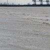
North of Port Talbot harbour, Aberafan Beach is a sandy beach that stretches 4 kilometres into the sea, facing south west into Swansea Bay. The beach is situated between two large rivers, the River Neath to the north west and River Afan to the south east, with the industrial town of Port Talbot directly behind it. As one of Wales' longest beaches, Aberafan Beach offers nearly three miles of sandy shoreline, backed by a two-mile long flat promenade that is popular with walkers, joggers, and cyclists. The promenade forms part of the Celtic Trail, a section of the National Cycle network.
Aberafan Beach is a well-known surf spot, attracting surfers due to its ability to hold a big swell, making it possible to catch good waves throughout the year. During the summer months, the beach hosts various events, including a popular beach festival.
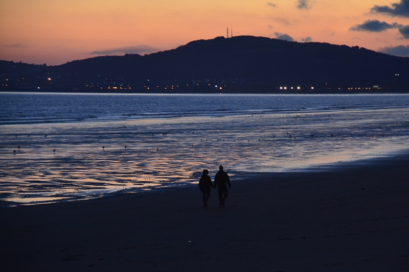
In contrast, Aberthaw Beach, located in the Vale of Glamorgan, is a tranquil coastal area rich in history and natural beauty. Once a bustling 16th-century port, it has transformed into a peaceful haven for visitors and wildlife. The beach features rocky shores with some sand at low tide, backed by the imposing Power Station with views over the Bristol Channel.
Aberthaw Beach is ideal for leisurely walks, wildlife watching, and enjoying the natural surroundings. The beach is also a popular sea fishing destination, attracting anglers. Although there are no facilities on the beach, visitors can stop at the nearby Blue Anchor Inn, a traditional thatched pub established in 1380, which welcomes dogs year-round.
Aberafan Beach is adjacent to the Wales Coast Path.
Harbour Sand
| Today | |
|---|---|
| Chance of rain | 100% |
| Max temperature | 15°C |
| feels like | 15°C |
| Wind 19mph | |
| Max UV Index |
| Tonight | |
|---|---|
| Chance of rain | 58% |
| Min temperature | 10°C |
| feels like | 11°C |
| Wind 18mph |
The tide at Aberafan Beach is currently falling. Low tide will be at approximately 3:12 PM, and the next high tide will be at approximately 9:38 PM.
![]() Today's air pollution levels are forecast to be Low
Today's air pollution levels are forecast to be Low
There is parking near the beach.
There are seasonal restrictions at Aberavon: https://www.npt.gov.uk/PDF/DogExclusionZone.pdf
Daily - 21st May - 4th September
Weekends - 30th April - 20th May
Easter Bank Holiday - 25th - 28th March
Good water quality
West Glamorgan Farmhouse

From £716.00 per week at Holidaycottages.co.uk
Rural Dyfed Farm Cottage

From £799.00 per week at Holidaycottages.co.uk
Rural West Glamorgan Cottage

From £530.00 per week at Holidaycottages.co.uk
Sycamore

From £1354.00 per week at Sykes Holiday Cottages
Carreg Cennen Cottage

From £1634.00 per week at Sykes Holiday Cottages
Alder

From £1354.00 per week at Sykes Holiday Cottages
Baked Bean Museum of Excellence (0.3 miles)
Go Ape (2.9 miles)
Margam Park (3.2 miles)
The Margam Ghost Walk (4.4 miles)
cafe remo's (300 yards)
Cinnamon Kitchen Indian Restaurant (360 yards)
All distances are approximate
less than a mile northwest as the seagull flies, less than a mile by road.
around 3 miles northwest as the seagull flies, around 6 miles by road.
around 3 miles northwest as the seagull flies, around 6 miles by road.
around 3 miles west-northwest as the seagull flies, around 7 miles by road.
around 4 miles south-southeast as the seagull flies, around 7 miles by road.
around 5 miles west-northwest as the seagull flies, around 10 miles by road.
around 6 miles west-northwest as the seagull flies, around 10 miles by road.
around 7 miles west-southwest as the seagull flies, around 15 miles by road.
around 7 miles west as the seagull flies, around 11 miles by road.
around 7 miles west-southwest as the seagull flies, around 15 miles by road.
around 7 miles west-southwest as the seagull flies, around 14 miles by road.
around 7 miles west-southwest as the seagull flies, around 15 miles by road.
around 7 miles west as the seagull flies, around 12 miles by road.
around 8 miles west as the seagull flies, around 13 miles by road.
around 8 miles west as the seagull flies, around 13 miles by road.
around 8 miles south-southeast as the seagull flies, around 11 miles by road.
around 8 miles west-southwest as the seagull flies, around 15 miles by road.
around 9 miles west as the seagull flies, around 16 miles by road.
around 10 miles southeast as the seagull flies, around 13 miles by road.
around 10 miles west as the seagull flies, around 16 miles by road.
Location: Aberavon, Port Talbot
Location type: Urban
OS Grid: SS740898
Coordinates: 51°35'35"N 3°49'10"W
Mapcode: GBR H2.BV9D
What 3 Words: sake.issue.slip
Coordinates and location codes are for an approximate mid-point of the beach, and may not reflect the best access point or the most popular part of the beach.
Country: Wales
Local Authority: Neath Port Talbot
Parish: Sandfields West
Nearest postcode: SA12 7QA
(for sat-nav purposes only, a beach does not have a postal address!)
Important! Beach information is compiled from a variety of different sources and is correct to the best of our knowledge at the time of compilation. However, information may be incorrectly supplied by our sources or go out of date after publication. BritishBeaches.uk makes no warranty as to the accuracy of any information on this page.
(Or après-beach. Or pre-beach. Or, just because you might want stuff)
Men's Tops
Weird Fish Larner 1/4 Zip Fair Isle Jumper Pale Denim Size 2XL

Only £28.00 from Weird Fish