Approximate Location Map
Use two fingers to pan or zoom the map
Use two fingers to pan or zoom the map
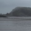
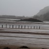
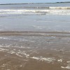
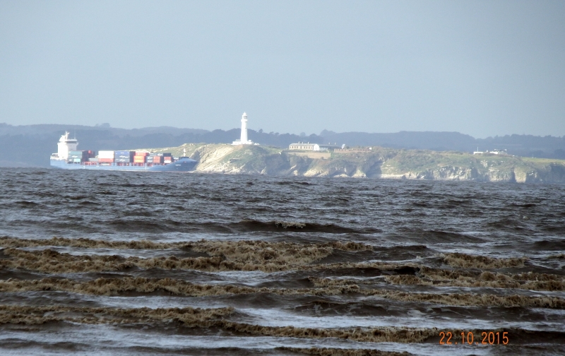
Weston-super-Mare Uphill Slipway is situated on the Somerset coast, overlooking the Bristol Channel, and is approximately 1.2 kilometres wide. The beach is next to the mouth of the River Axe and has a sandy shoreline, although the Bristol Channel's large tidal range can expose mud at low water.
Uphill beach is a world apart from the main Weston-super-Mare seaside resort, with fewer facilities available. However, the beach offers parking on the beach itself, as well as expansive sandy areas. The River Axe flows out to sea at Uphill, and behind the beach lies Uphill Local Nature Reserve, which features an abundance of wildlife and a tower with great views of the beach and coast below.
Uphill beach shares similarities with Brean beach, located on the far side of Brean Downs. Both beaches are sandy and expansive, with parking available on the beach. However, Uphill beach has the added feature of the River Axe flowing out to sea, and visitors are advised not to attempt to cross the river at low tide due to the risk of getting stuck in the mud.
Uphill beach is dog friendly, and the surrounding area offers opportunities for horse riding along the beach. Visitors can also explore Uphill Local Nature Reserve and enjoy the views from the tower.
Sand
| Today | |
|---|---|
| Chance of rain | 100% |
| Max temperature | 16°C |
| feels like | 16°C |
| Wind 22mph | |
| Max UV Index |
| Tonight | |
|---|---|
| Chance of rain | 58% |
| Min temperature | 11°C |
| feels like | 11°C |
| Wind 22mph |
The tide at Weston-super-Mare Uphill Beach is currently falling. Low tide will be at approximately 3:13 PM, and the next high tide will be at approximately 10:01 PM.
![]() Today's air pollution levels are forecast to be Low
Today's air pollution levels are forecast to be Low
Parking and disabled parking are available.
Dogs are welcome in the section of the beach from Royal Sands to Uphill all year around. There are restrictions to the north of the beach.
No lifeguard cover at this beach
Sufficient water quality
Primrose

From £3726.00 per week at Sykes Holiday Cottages
7a Cathedral Green

From £413.00 per week at Rural Retreats
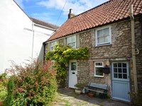
Luxury Somerset Lodge

From £945.00 per week at Holidaycottages.co.uk
Cherry Lodge

From £1804.00 per week at Sykes Holiday Cottages
Somerset Cottage
From £610.00 per week at Holidaycottages.co.uk
The Dairy

From £1513.00 per week at Sykes Holiday Cottages
Uphill Local Nature Reserve (0.6 miles)
Brean Down (0.9 miles)
Water adventure park (1.3 miles)
Weston Sand Sculpture Festival (1.4 miles)
Weston Museum (1.9 miles)
The Playhouse (1.9 miles)
Queens Arms Bleadon (2.1 miles)
Animal Farm Adventure Park (2.5 miles)
Fun City at Brean Leisure Park (2.7 miles)
La Cucina (480 yards)
All distances are approximate
less than a mile north-northeast as the seagull flies, around 2 miles by road or less than a mile on foot using coastal paths.
just over a mile north-northeast as the seagull flies, around 2 miles by road or just over a mile on foot using coastal paths.
around 2 miles north-northeast as the seagull flies, around 2 miles by road or 2 miles on foot using coastal paths.
around 2 miles south-southwest as the seagull flies, around 7 miles by road or 3 miles on foot using coastal paths.
around 2 miles north as the seagull flies, around 3 miles by road or 2 miles on foot using coastal paths.
around 3 miles south-southwest as the seagull flies, around 8 miles by road or 4 miles on foot using coastal paths.
around 4 miles north-northeast as the seagull flies, around 7 miles by road or 4 miles on foot using coastal paths.
around 4 miles south-southwest as the seagull flies, around 10 miles by road or 6 miles on foot using coastal paths.
around 6 miles south as the seagull flies, around 10 miles by road or 7 miles on foot using coastal paths.
around 7 miles south as the seagull flies, around 11 miles by road or 8 miles on foot using coastal paths.
around 10 miles northeast as the seagull flies, around 13 miles by road.
around 10 miles northeast as the seagull flies, around 13 miles by road.
around 10 miles west-northwest as the seagull flies, around 62 miles by road.
around 11 miles northwest as the seagull flies, around 60 miles by road.
around 12 miles west-northwest as the seagull flies, around 68 miles by road.
around 13 miles west-northwest as the seagull flies, around 69 miles by road.
around 13 miles west-northwest as the seagull flies, around 69 miles by road.
around 13 miles west-northwest as the seagull flies, around 69 miles by road.
around 14 miles west-northwest as the seagull flies, around 69 miles by road.
around 14 miles west-northwest as the seagull flies, around 69 miles by road.
Location: Uphill, Weston-Super-Mare
Location type: Urban
OS Grid: ST310587
Coordinates: 51°19'24"N 2°59'26"W
Mapcode: GBR J6.WSJ0
What 3 Words: banks.noon.mute
Coordinates and location codes are for an approximate mid-point of the beach, and may not reflect the best access point or the most popular part of the beach.
Country: England
Local Authority: North Somerset
Parish: Weston-super-Mare
Nearest postcode: BS23 4XY
(for sat-nav purposes only, a beach does not have a postal address!)
Important! Beach information is compiled from a variety of different sources and is correct to the best of our knowledge at the time of compilation. However, information may be incorrectly supplied by our sources or go out of date after publication. BritishBeaches.uk makes no warranty as to the accuracy of any information on this page.
(Or après-beach. Or pre-beach. Or, just because you might want stuff)
Men's Tops
Weird Fish Cruiser 1/4 Zip Macaroni Sweatshirt Army Green Size XL

Only £45.00 from Weird Fish