Approximate Location Map
Use two fingers to pan or zoom the map
Use two fingers to pan or zoom the map
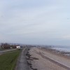
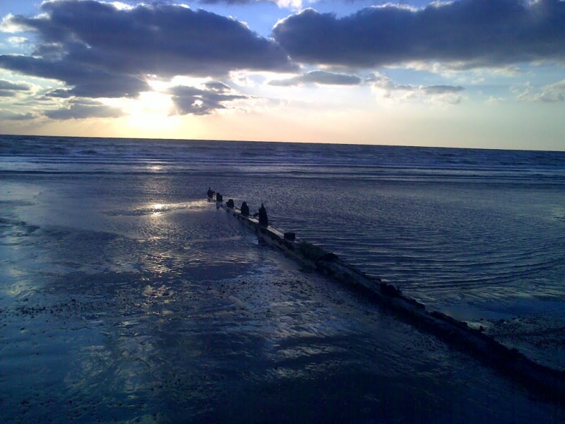
St Mary's Bay is a resort beach situated along a 20 kilometre stretch of beach in Hythe Bay, Kent. The beach is predominantly shingle with wide shallow sand flats exposed at low water. At low tide, the sand stretches out about half a mile, and the Romney to Dymchurch steam railway runs past the beach. The beach has a wide concrete footway and a low sea wall, making it an ideal spot for walkers and those looking to enjoy the sea views.
In the summer season, a kiosk opens on the promenade selling drinks and snacks. The beach is particularly popular with bathers during the summer months. Visitors can also take a ride on the nearby Romney, Hythe and Dymchurch narrow-gauge railway, which runs close to the beach. The land close to the beach was developed as a resort in the 1920s and reached its peak in the 1960s.
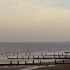
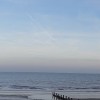
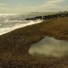
Located at the southern end of St Mary's Bay, near Dymchurch, is Pirate Springs, a quiet and almost secret stretch of beach. This peaceful spot is perfect for walkers and popular for fishing. The beach here is mostly shingle, with some sand exposed at low tide. Although there are no shops, cafés, or toilets at Pirate Springs, visitors can easily access amenities in Dymchurch and St Mary's Bay, which are just a short walk away.
Access to Pirate Springs is easy via the sea wall path, part of the long coastal trail that links the villages along Romney Marsh. Visitors can park in St Mary's Bay or Dymchurch and walk along the path, which is flat and scenic, ideal for both walking and cycling. A coffee truck is also available on most days between 8am-12pm.
Romney Marsh, located south-west of the beach, is home to a variety of wildlife, making it an excellent spot for nature lovers and those looking to explore the local ecosystem. Dog walkers also love Pirate Springs, as it is generally quiet, and dogs are welcome all year round, with no seasonal bans in place.
St Mary's Bay is adjacent to the Kent Coastline Walk.
Sand Shingle
| Today | |
|---|---|
| Chance of rain | 77% |
| Max temperature | 17°C |
| feels like | 17°C |
| Wind 30mph | |
| Max UV Index |
| Tonight | |
|---|---|
| Chance of rain | 28% |
| Min temperature | 11°C |
| feels like | 12°C |
| Wind 22mph |
The tide at St Mary's Bay is currently falling. Low tide will be at approximately 8:54 AM, and the next high tide will be at approximately 2:07 PM.
![]() Today's air pollution levels are forecast to be Low
Today's air pollution levels are forecast to be Low
There is a large car park off Dymchurch Road, which is just behind the beach.
Seasonal restrictions apply, please check beach signs for more information.
No lifeguard cover at this beach
Good water quality
Rye House

From £2337.00 per week at Sykes Holiday Cottages
Rural Kent Cottage
From £959.00 per week at Holidaycottages.co.uk
Luxury Romantic Kent Cottage
From £773.00 per week at Holidaycottages.co.uk
Romantic Quirky East Sussex Apartment
From £519.00 per week at Holidaycottages.co.uk
Quirky Kent Cottage
From £837.00 per week at Holidaycottages.co.uk
Willow Cottage

From £4546.00 per week at Sykes Holiday Cottages
Dymchurch Amusement Park (1.1 miles)
Dymchurch Martello Tower No.24 (1.1 miles)
Romney Marsh Visitor Centre (1.4 miles)
Romney, Hythe and Dymchurch Railway (2.2 miles)
Alpaca Annie (2.3 miles)
Romney Marsh (2.5 miles)
Smugglers' Alehouse (2.6 miles)
All distances are approximate
less than a mile north-northeast as the seagull flies, just over a mile by road.
just over a mile northeast as the seagull flies, just over a mile by road.
around 2 miles south-southwest as the seagull flies, around 4 miles by road or 2 miles on foot using coastal paths.
around 3 miles northeast as the seagull flies, around 3 miles by road.
around 5 miles south as the seagull flies, around 6 miles by road or 5 miles on foot using coastal paths.
around 6 miles northeast as the seagull flies, around 7 miles by road.
around 7 miles northeast as the seagull flies, around 9 miles by road.
around 8 miles southwest as the seagull flies, around 9 miles by road.
around 8 miles east-northeast as the seagull flies, around 10 miles by road.
around 10 miles east-northeast as the seagull flies, around 16 miles by road or 11 miles on foot using coastal paths.
around 10 miles west-southwest as the seagull flies, around 12 miles by road.
around 11 miles east-northeast as the seagull flies, around 16 miles by road.
around 13 miles west-southwest as the seagull flies, around 18 miles by road.
around 15 miles east-northeast as the seagull flies, around 21 miles by road.
around 16 miles east-northeast as the seagull flies, around 21 miles by road.
around 18 miles southwest as the seagull flies, around 23 miles by road.
around 20 miles east-northeast as the seagull flies, around 26 miles by road.
around 21 miles west-southwest as the seagull flies, around 26 miles by road.
around 22 miles west-southwest as the seagull flies, around 28 miles by road.
around 22 miles northeast as the seagull flies, around 28 miles by road.
Location: St Mary's Bay
Location type: Town
OS Grid: TR094276
Coordinates: 51°0'36"N 0°59'1"E
Mapcode: GBR SZX.PHF
What 3 Words: parkland.pirates.fade
Coordinates and location codes are for an approximate mid-point of the beach, and may not reflect the best access point or the most popular part of the beach.
County: Kent
Country: England
Local Authority: Shepway
Parish: St. Mary in the Marsh
Nearest postcode: TN29 0RN
(for sat-nav purposes only, a beach does not have a postal address!)
Important! Beach information is compiled from a variety of different sources and is correct to the best of our knowledge at the time of compilation. However, information may be incorrectly supplied by our sources or go out of date after publication. BritishBeaches.uk makes no warranty as to the accuracy of any information on this page.
(Or après-beach. Or pre-beach. Or, just because you might want stuff)
Men's Tops
Weird Fish Fawlty Trouters Back Print Artist T-Shirt Navy Size 3XL

Only £28.00 from Weird Fish